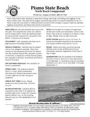
Pismo Beach North Campground Map
Map of park with detail of trails and recreation zones
284 miles away
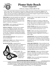
Pismo Beach Oceano Campground Map
Map of oceano campground region of park with detail of trails and recreation zones
285 miles away
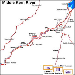
Middle Kern River Area Map
This majestic, rugged, canyon portion of the Kern River extends from Lake Isabella to the Upper...
286 miles away
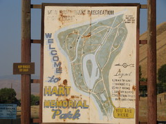
Hart Memorial Park Map
286 miles away

Lake Isabella Map and Statistics
287 miles away

Lake Isabella Camping and Fishing Map
287 miles away

Sequoia (South) National Forest Visitor Map: Lake...
287 miles away

Kern River Valley Area Map
287 miles away

Upper Kern River Area Recreation Opportunities Map
287 miles away
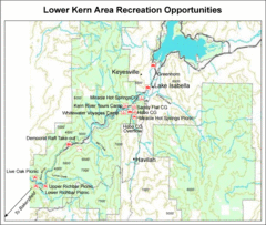
Lower Kern River (Kern Canyon) Area Recreation...
287 miles away

Lake Isabella Area Recreation Opportunities Map
287 miles away

Bakersfield Commons Site Features Map
287 miles away

Bakersfield Commons Conceptual Site Plan Map
287 miles away

Bakersfield Commons Phase 1 Alt Map
287 miles away

Bakersfield Commons Existing and Proposed Zoning...
287 miles away
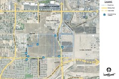
Bakersfield Commons Noise Monitoring Map
287 miles away

Bakersfield Commons Site Existing Conditions Map
287 miles away

Bakersfield Commons Proposed Retention Areas Map
287 miles away
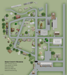
Kern County Museum Map
287 miles away
Bakersfield College Campus Map
Bakersfield College Campus Map. All buildings shown.
287 miles away

Lower Kern River Map
This portion of the Kern River extends from the Lower Richbar picnic area to Hart Park. Although...
288 miles away
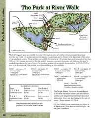
The Park at Riverwalk, Bakersfield California Map
Map of The Park at Riverwalk in Bakersfield California, including the fees for reservable areas.
288 miles away

Lake Ming Area Map
Lake Ming is located 10 miles northeast of Bakersfield, off of Hwy. 178 along Alfred Harrell Hwy...
288 miles away

Town & Country Village Shopping Center in...
288 miles away
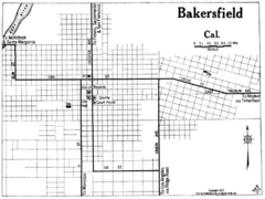
Bakersfield California, 1917 Map
288 miles away
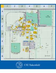
California State University Bakersfield Map
Campus map of California State University Bakersfield.
289 miles away

Kern County California Map
289 miles away

Kern County District Supervisor Areas Map
Last Modified 12/13/2005
289 miles away
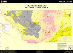
Fire Hazard Severity Zones, Kern County...
Fire Hazard Severity Zones, Kern County California: Local Responsibility Area
289 miles away

Fire Hazard Severity Zones, Kern County...
Fire Hazard Severity Zones, Kern County California: State Responsibility Area
289 miles away

Census Places and Cities in Kern County...
289 miles away

Kern County, 1916 Map
Kern County, 1916 Map, from California Mineral Production for 1919 (with County Maps), Bulletin No...
289 miles away

Kern County Boat Ramps Locator Map
The numbered locations can be found at http://www.boatrampslocator.com/california-kern-county-boat...
289 miles away
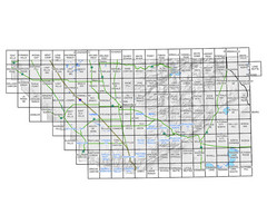
Awareness Floodplain Maps, Kern County Map
The maps labeled in blue have completed Awareness Floodplain Maps. The maps labeled in black are...
289 miles away

Kern County Map
289 miles away
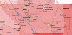
Bakersfield's Location in Kern County Map
289 miles away
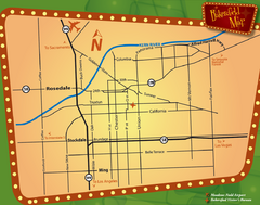
Bakersfield Overview Map
Shows major streets and highways in Bakersfield, CA
289 miles away
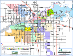
Bakersfield Police Beats Map
289 miles away

Bakersfield California 1889 Map
Map of Bakersfield, CA, showing the first subdivision of lands belonging to J. B. Haggin, 1889
289 miles away

Bakersfield E Zone map
City of Bakersfield Economic & Community Development supports economic diversity, civic growth...
289 miles away

