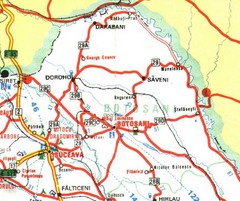
Botosani Map
1891 miles away
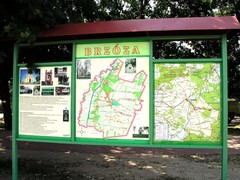
Brzoza_Glowaczow_Poland.jpg Map
Street map of Brzoza_Glowaczow_Poland.jpg - a "heavy-duty" street map after 6 years on...
1891 miles away
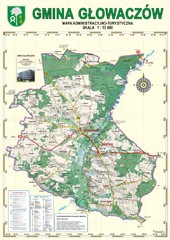
Gmina Glowaczow - Mazovia PL Map
That is a Głowaczów commune / Mazovia PL wall map. Created with use of GlobalMapper...
1891 miles away
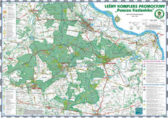
PuszczaKozienicka tourist map
LKP - Lesny Kompleks Promocyjny - PuszczaKozienicka - tourist map Ed. 2010 Projection: UTM/WGS84...
1893 miles away
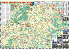
Zwolen_county_folded_map_POLAND Map
Zwolen county, paper folded map Scale 1: 70 000 Projection UTM/WGS84, GPS compatibile verified...
1894 miles away
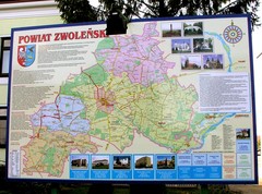
Zwolen county street map
Zwolen county - street map Big size 200 x 300 cm waterproof map
1894 miles away

AFG Security & Poppy Cultivation 2008 Map
1894 miles away
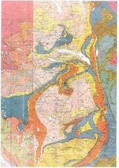
Oppdal Geologic Map
Map of geology around Oppdal, Norway
1896 miles away
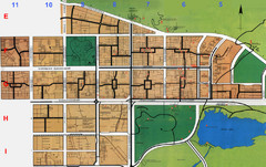
Islamabad City Map
City map of Islamabad, Pakistan
1897 miles away
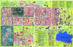
Islamabad Map
Street map of Islamabad; shows all buildings. Breakout map of central Rawalpindi.
1897 miles away
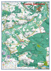
Jastrzebia commune 3D Map
Jastrzebia commune - 3D map Ed. 2010 Projection UTM/WGS84 Scale 1:25 000 Mede with extensive use...
1899 miles away
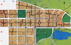
Islamabad Map
1899 miles away
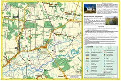
Bartodzieje_Village_Jastrzebia_Poland_streetmap...
Map of Bartodzieje_Village_Jastrzebia_Poland_streetmap.pdf is a street informative map of dimension...
1899 miles away
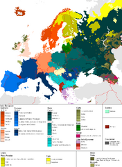
Languages of Europe Map
A map of the languages in Europe and where they originate.
1900 miles away
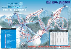
Bukovel Ski Resort Map
Map of Bukovel's slopes, lifts and resort
1900 miles away
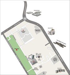
Overseas Pakistanis Foundation Ministery Map
1901 miles away

Mashhad, Iran 1971 Map
A map from 1971 of Mashhad, Iran
1902 miles away
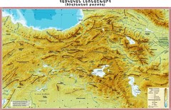
Armenian Highland Map
Map of the Armenian Haghland
1906 miles away
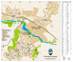
Suceava Tourist Map
Tourist map of Suceava, Romania. Shows restaurants, hotels, and other points of interest...
1909 miles away
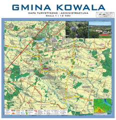
Kowala Commune - near Radom, PL Map
Kowala-Stepocina Commune - the administrative and touristic wall map, scala 1:12500, with 3D effect...
1910 miles away
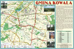
Kowala_Mazovia_poland.jpg Map
Map of Kowala_Mazovia_poland.jpg is a Kowala commune map, created with use of GlobalMapper and...
1913 miles away
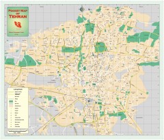
Tehran Street Map
Street map of Tehran, Iran. Shows highways, major streets, parks, and embassy locations
1913 miles away
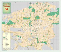
Tehran, Iran Map
Tehran Street Map. Shows locations of all most important buildings including mosques, museums...
1913 miles away
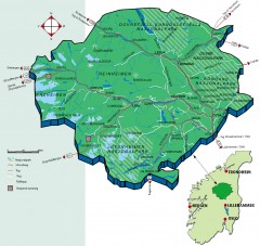
Nasjonalparkriket National Park Region Map
The national parks region "Nasjonalparkriket" is centrally located between the cities of...
1914 miles away
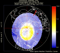
Aurora Borealis in Real Time Map
Aurora Borealis as seen by satellite superimposed on the northern hemisphere of the globe.
1919 miles away
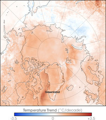
Arctic Temperature Change: 1987 -- 2007 Map
1919 miles away

Hessdal and Oslo, Norway Map
Roads and areas surrounding Oslo, Norway
1921 miles away
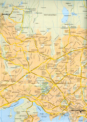
Oslo City Map
City map of central Oslo, Norway. Oslo Central Station highlighted.
1922 miles away
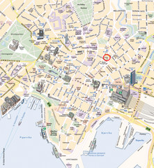
Oslo Tourist Map
Tourist map of central Oslo, Norway, capital and largest city in Norway. Shows streets, city parks...
1922 miles away
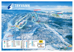
Tryvann Vinterpark Ski Trail Map
Trail map from Tryvann.
1922 miles away
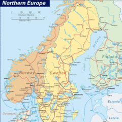
Northern Europe Tourist Map
1923 miles away
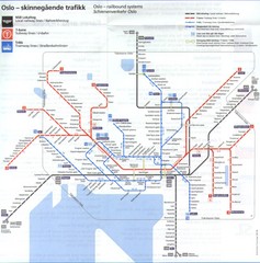
Oslo, Norway Public Transportation Map
1923 miles away
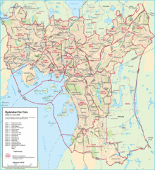
Oslo Neighborhood Map
Shows neighborhoods in city of Oslo, Norway
1923 miles away
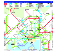
Oslo Public Transport Map
Shows metro, tramway, main bus service, and ferries.
1923 miles away
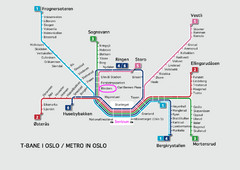
Oslo Metro Map
A map of the Metro lines in Oslo
1923 miles away
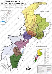
NWFP Division Map
Federally administered tribal area divisions in Pakistan as of 1995.
1925 miles away
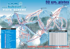
'Bukovel' Ski Resort Piste Map
Bukovel Ski Resort Piste Scheme. Near Yaremcha, Ukraine
1927 miles away
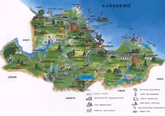
Samsun Tourist Map
Tourist map of Samsun, Turkey area on the Black Sea. Shows points of interest.
1928 miles away


