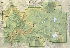
Lassen Volcanic National Park Map
255 miles away
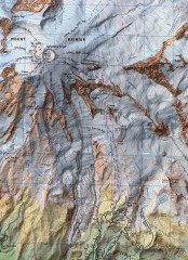
Mt. Rainier Climbing Routes Map
Shows major climbing routes on Mt. Rainier on southwest part of mountain.
255 miles away

Mt. Rainier 3D Print Map
This is a 3D-printed map of the cone of Mt. Rainier in Washington, USA, including Liberty Cap, many...
255 miles away
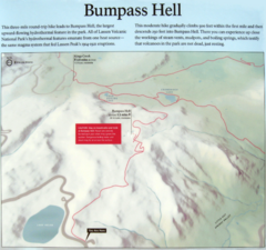
Bumpass Hell Trail Map
Trail map of route to Bumpass Hell, a major area of geo-thermal activity in Lassen National Park...
255 miles away
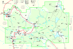
Lassen Volcanic National Park Official Park Map
Official NPS map of Lassen Volcanic National Park in California. Map shows all areas. Lassen...
256 miles away
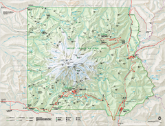
Mount Rainier National Park map
Official NPS map of Mt. Rainier National Park. Shows the entire park and surroundings
256 miles away
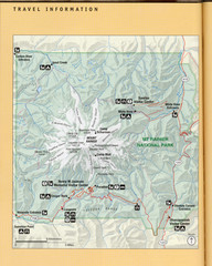
Mount Rainier National Park Map
Guide to the Mount Rainier National Park
257 miles away
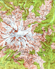
Mount Rainier Topographic Map
Guide to topography and glaciers of Mount Rainier
257 miles away
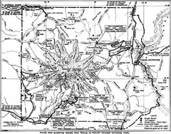
1928 Mount Rainier National Park Map
Guide to Mount Rainier National Park in 1938
258 miles away
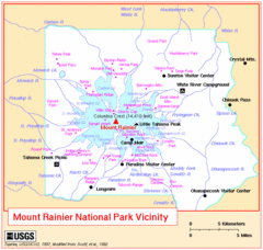
Mount Rainier National Park Vicinity Map
258 miles away
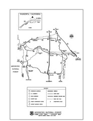
Mendocino National Forest map
Map of the Nome Cult Trail Walk in the Mendocino National Forest.
258 miles away
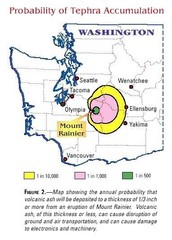
Mount Rainier Probability of Tephra (Ash...
259 miles away
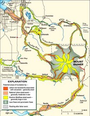
Mount Rainier Potential Lava Flow, Mud Flow and...
Hazard zones for lahars, lava flows, and pyroclastic flows from Mount Rainier. The map shows areas...
260 miles away
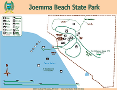
Joemma Beach State Park Map
Map of park with detail of trails and recreation zones
261 miles away
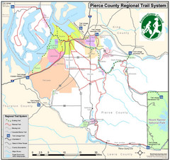
Pierce County Regional Trail Map
County-wide system of trails
261 miles away
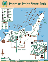
Penrose Point State Park Map
Map of park with detail of trails and recreation zones
264 miles away
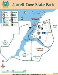
Jarrell Cove State Park Map
Map of park with detail of trails and recreation zones
264 miles away
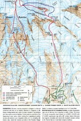
Mount Rainier Topo Map
Map of Mount Rainier Ascent. We ascended the "Muir Snowfield" and then went up the "...
265 miles away
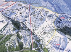
Crystal Mountain Ski Trail Map - Northway Area
Official ski trail map of the Northway area of Crystal Mountain ski area from the 2007-2008 season...
265 miles away
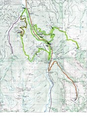
White River 50 Course Map
White River 50 Mile Trail Run
266 miles away
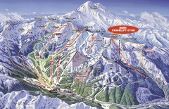
Crystal Mountain Ski Trail Map
Official ski trail map of Crystal Mountain ski area from the 2007-2008 season. 2600 acres of...
266 miles away
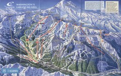
Crystal Mountain Resort Ski Trail Map
Trail map from Crystal Mountain Resort, which provides downhill skiing. It has 10 lifts servicing...
267 miles away
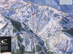
Crystal Mountain Resort Northway Inset Ski Trail...
Trail map from Crystal Mountain Resort, which provides downhill skiing. It has 10 lifts servicing...
267 miles away
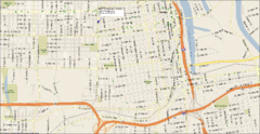
Tacoma, Washington City Map
267 miles away
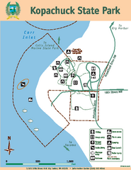
Kopachuck State Park Map
Map of island with detail of trails and recreation zones
268 miles away
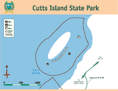
Cutts Island Stay Park Map
Map of park with detail of trails and recreation zones
269 miles away
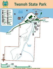
Twanoh State Park Map
Map of park with detail of trails and recreation zones
269 miles away
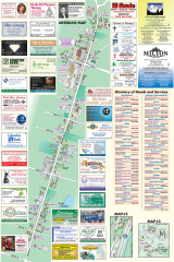
Milton tourist map
Tourist map of Milton, Washington. Shows all businesses.
270 miles away
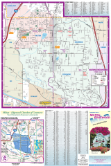
Milton and Edgewood tourist map
Tourist map of Milton and Edgewood, Washington. Shows all businesses.
270 miles away
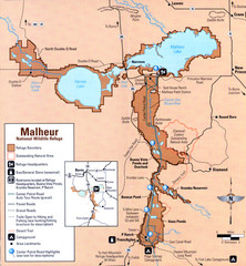
Malheur National Wildlife Refuge Map
Detailed Map of the Malheur Wildlife Refuge in Oregon showing places of interest, roads and...
270 miles away
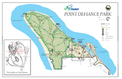
Point Defiance Park Map
270 miles away

Pacific Crest Trail Map
Shows entire route of 2,650 mile Pacific Crest Trail from Mexico to Canada.
271 miles away
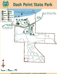
Dash Point State Park Map
Map of park with detail of trails and recreation zones
273 miles away
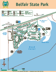
Belfair State Park Map
Map of park, with detail of trails and recreation zones
274 miles away

Yakima, Washington City Map
275 miles away
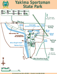
Yakima Sportsman State Park Map
Map of park with detail of trails and recreation zones
276 miles away
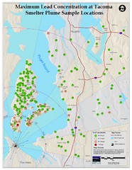
Tacoma Lead Concentration Map
A map of maximum lead concentrations near Tacoma.
277 miles away
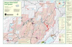
Tahuya State Forest Trail Map
Shows trails of Tahuya State Forest. Show roads, doubletrack, singletrack, and 4WD only.
277 miles away
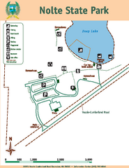
Nolte State Park Map
Map of park with detail of trails and recreation zones
278 miles away
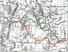
Oregon Trail Map
Old sketch map with modern cities, forts/ trading posts, and missions/churches superimposed. Shows...
279 miles away

