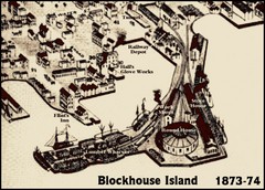
Blockhouse Island Map 1874
Bird’s Eye view map of Brockville created by artist Herman Brosius and the lithographers...
158 miles away
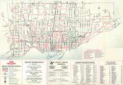
1976 Toronto City Map
Guide to transit and subway systems, points of interest and major roads
158 miles away

Toronto Average House Prices Map
158 miles away

Toronto Subway Map
Official RT/subway map of the Toronto Transit Commission.
158 miles away
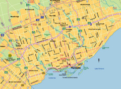
Toronto City Map
Street map of Toronto city
158 miles away
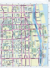
Toronto Canada Downtown Tourist Map
Tourist map for Downtown Toronto, Canada. Street leve map with tourist site highlighted. Subway...
158 miles away
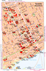
Toronto Downtown Map
158 miles away
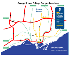
George Brown College Campus Map
George Brown College Campus Map. Shows all buildings.
159 miles away
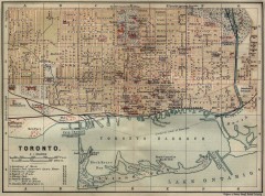
Antique map of Toronto from 1894
"Toronto" from Baedeker, Karl. The Dominion of Canada with Newfoundland and an Excursion...
159 miles away
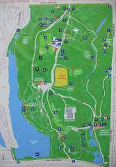
High Park Map
160 miles away
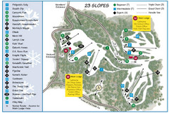
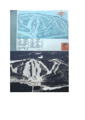
Caledon Ski Club Ski Trail Map
Trail map from Caledon Ski Club, which provides downhill skiing. This ski area has its own website.
161 miles away

Ogdensburg, New York Historical Map
A wonderful highlight are the art reproductions of homes and buildings which surround the map...
162 miles away
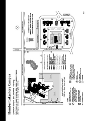
Humber College Lakeshore Campus Map
Humber College Lakeshore Campus Map. Map is of both East and West Campus. Shows all buildings.
164 miles away

Terry Fox Run Trail Map
167 miles away
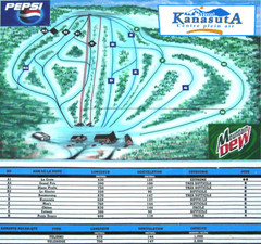
Mont Kanasuta Ski Trail Map
Trail map from Mont Kanasuta, which provides downhill skiing. This ski area has its own website.
169 miles away

1871 Southern Ontario District Map
Map of 1871 Districts
171 miles away

Rattlesnake Point Trail Map
176 miles away

Manitoulin Island Map
The largest Island on a lake
176 miles away
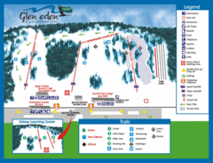
Glen Eden Ski Trail Map
Trail map from Glen Eden, which provides downhill skiing. This ski area has its own website.
178 miles away

Hilton Falls Trail Map
Guide to Hilton Falls Conservation Area and Reservoir
178 miles away

Dry Hill Ski Area Ski Trail Map
Trail map from Dry Hill Ski Area.
179 miles away
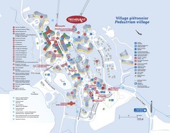
Mont Tremblant Village Map
183 miles away
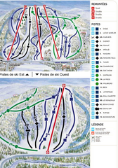
Gray Rocks Ski Trail Map
Trail map from Gray Rocks, which provides downhill skiing. This ski area has its own website.
184 miles away
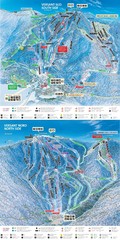
Tremblant Ski Trail Map
Trail map from Tremblant, which provides downhill skiing. This ski area has its own website.
185 miles away
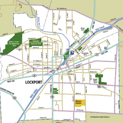
Lockport, New York Map
Map of downtown Lockport, New York, with parks, hospitals, and other points of interest shown.
185 miles away
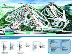
Mont Blanc Ski Trail Map
Trail map from Mont Blanc, which provides downhill skiing. This ski area has its own website.
189 miles away

Downtown Rochester, New York Map
Tourist map of downtown Rochester, New York. Various areas of interest, parking, and streets are...
189 miles away

Rochester, New York City Map
189 miles away
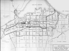
1959 Transit Routes of Hamilton Harbor Map
190 miles away
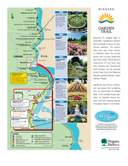
Niagara Garden Trail Map
Tourist map of attractions along the Garden Trail along the Canadian side of the St. Lawrence River...
190 miles away
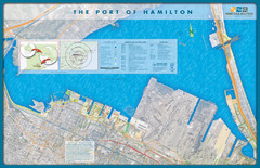
Port of Hamilton Map
Shows piers and tenants of Port of Hamilton, Ontario
191 miles away
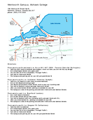
Mohawk College - Wentworth Campus Map
Mohawk College - Wentworth Campus Map. All buildings shown.
192 miles away
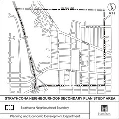
Strathcona Neighbourhood Map
192 miles away
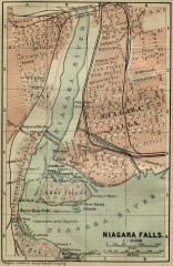
Antique map of Niagara Falls from 1894
"Niagara Falls" from Baedeker, Karl. The Dominion of Canada with Newfoundland and an...
192 miles away

St. John Fisher College Map
Campus map
193 miles away
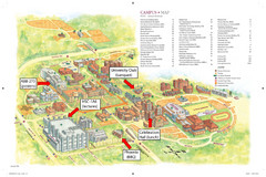
McMaster University Map
Campus map
193 miles away

Niagara Falls Map
Photographic Map of Niagara Falls - tourist / visitor information.
193 miles away
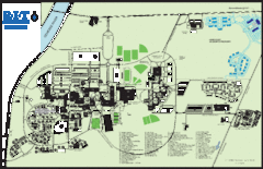
Rochester Institute of Technology Campus Map
Map of RIT campus.
193 miles away
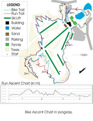
Chicopee Ski Club Summer Ski Trail Map
Trail map from Chicopee Ski Club, which provides downhill skiing. This ski area has its own website.
193 miles away

