California maps
Top Contributors..See top 100...
-
65
FadedMemory
-
50

Mapophile
-
44

Brigid
-
29

nava
Claim the World, Map by Map
Claim a country by adding the most maps.Celebrate your territory with a Leader’s Boast.
Become World Leader by claiming the most!

 Add a Map to begin


 Sign In to begin

California Cities by Map Count..Sort by name
- 66San Francisco maps
- 37Bakersfield maps
- 27San Diego maps
- 23Los Angeles maps
- 10San Jose maps
- 9Santa Monica maps
- 8Long Beach maps
- 8Mammoth Lakes maps
- 8Mill Valley maps
- 8Sacramento maps
- 7Lake Isabella maps
- 7Mendocino maps
- 7Oakland maps
- 7Redwood City maps
- 6Monterey maps
- 6Oxnard maps
- 6Riverside maps
- 6Santa Clara maps
- 6Santa Cruz maps
- 6Truckee maps
- 5Berkeley maps
- 5Fort Ross maps
- 5Philo maps
- 5Santa Barbara maps
- 5South Lake Tahoe maps
- 5Tahoma maps
- 4Anaheim maps
- 4Chico maps
- 4Chino Hills maps
- 4Coronado maps
- 4Fresno maps
- 4Fullerton maps
- 4Los Altos maps
- 4Rio Vista maps
- 4San Luis Obispo maps
- 4Tiburon maps
- 4West Hollywood maps
- 4Westwood maps
- 4Wrightwood maps
- 3Cambria maps
- 3Carnelian Bay maps
- 3Culver City maps
- 3El Cerrito maps
- 3Eureka maps
- 3Fairfax maps
- 3Friant maps
- 3Glen Ellen maps
- 3Half Moon Bay maps
- 3Isleton maps
- 3La Jolla maps
Related Info
California Keywords
airport airports attractions beach biking boating bus campground camping campus city college country downhill downtown elevation fishing fun hike hiking history hotel hotels island lake map mountain mountains national national park park parks public recreation reference river road roads shopping ski area skiing state state park street street map subway summer topo tourism tourist town trail trails train transportation travel united states university walk water
California Maps
Auburn State Recreation Area Map
Map of park with detail of of trails and recreation zones
Near 501 El Dorado St, Auburn, CA
Awareness Floodplain Maps, Kern County Map
The maps labeled in blue have completed Awareness Floodplain Maps. The maps labeled in black...
Near Bakersfield, Ca.
Badger Pass Ski Trail Map
Official ski trail map of Badger Pass ski area
Near Yosemite National Park, California
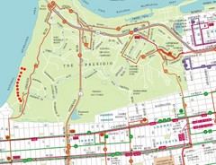
Baker Beach, San Francisco Tourist Map
Near Baker Beach, San Francisco

Bakersfield California 1889 Map
Map of Bakersfield, CA, showing the first subdivision of lands belonging to J. B. Haggin, 1889
Near Bakersfield, Ca.
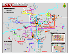
Bakersfield California Bus System Map (G.E.T...
Entire system map of all routes Golden Empire Transit offers in the City of Bakersfield...
Near Bakersfield, Ca.
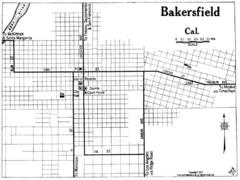
Bakersfield California, 1917 Map
Near Bakersfield, Ca

Bakersfield City Limits Map
Near Bakersfield, Ca.

Bakersfield College Campus Map
Bakersfield College Campus Map. All buildings shown.
Near 1801 Panorama Drive Bakersfield, CA 93305

Bakersfield Commons Conceptual Site Plan Map
Near 1500 Coffee Road, Bakersfield, CA 93311

Bakersfield Commons Existing and Proposed...
Near 1500 Coffee Road, Bakersfield, CA 93311
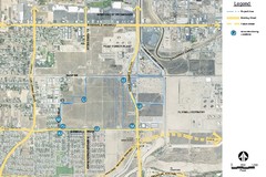
Bakersfield Commons Noise Monitoring Map
Near 1500 Coffee Road, Bakersfield, CA 93311

Bakersfield Commons Phase 1 Alt Map
Near 1500 Coffee Road, Bakersfield, CA 93311

Bakersfield Commons Proposed Retention Areas Map
Near 1500 Coffee Road, Bakersfield, CA 93311

Bakersfield Commons Site Existing Conditions Map
Near 1500 Coffee Road, Bakersfield, CA 93311

Bakersfield Commons Site Features Map
Near 1500 Coffee Road, Bakersfield, CA 93311

Bakersfield E Zone map
City of Bakersfield Economic & Community Development supports economic diversity, civic...
Near Bakersfield, Ca.
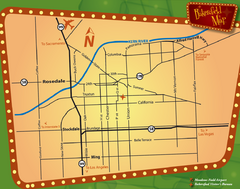
Bakersfield Overview Map
Shows major streets and highways in Bakersfield, CA
Near Bakersfield, California
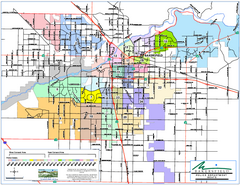
Bakersfield Police Beats Map
Near Bakersfield, Ca.


 Explore Maps
 Map Directory


 Maps contributed


