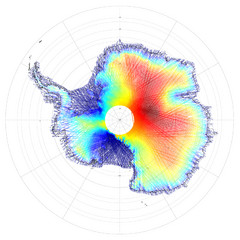
“satellite imagery” maps from Antarctica

Antarctica Land and Ice Elevation Map
The colors on the map above represent ICESat’s measurements of Antarctica’s topography...
Near Antartica
3081 × 3081•2.7 MB•JPG
page 1 of 1
“satellite imagery” maps from Antarctica

The colors on the map above represent ICESat’s measurements of Antarctica’s topography...