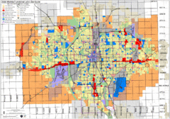
Wichita Functional Land Use Guide Map
Development map for future land use by 2030
0 miles away
Near Wichita, KS, US
1728 × 1210•851 KB•GIF
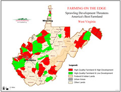
West Virginia Farmland Development Map
Map shows quality of farmland along with developments.
920 miles away
Near West Virginia
2560 × 1950•460 KB•JPG
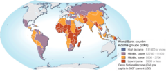
World map of World Bank country income groups
The World Bank has grouped countries based on the average income. These groupings are frequently...
5339 miles away
Near Global
950 × 413•69 KB•PNG
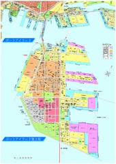
Port Island 2nd Stage Map
Map of Port Island in Kobe City shows 2nd Stage that has been constructed on the southern end of...
6416 miles away
Near Kobe City
1413 × 2000•864 KB•JPG
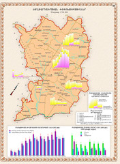
Karabakh Map
Demographic Development of the Nagorno-Karabakh Republic (Artsakh)
6568 miles away
Near Armenia
803 × 1093•730 KB•JPG
page 1 of 1


 Explore Maps
 Map Directory
