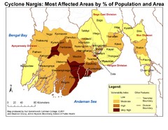
Cyclone Nargis Affected Area Map
Cyclone Nargis Vulnerability Estimates by Township
0 miles away
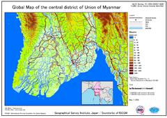
Elevation Map Central Distrisct of Union of...
The map shows topography of the Ayeyarwady (Irrawady) Delta and the Sittoung (Sittang) Delta, that...
52 miles away
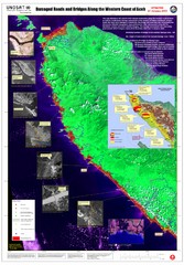
Aceh Damage Map
A detailed annotated satellite map, clearly showing the extent of the destruction along the most...
772 miles away
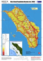
Nias Island Population Density Map
Density map for time of8.7 magnitude Earthquake March 28, 2005
1073 miles away
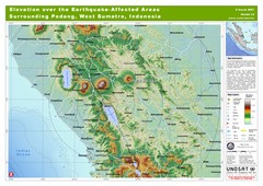
Elevation Over the Earthquake -Affected Areas of...
This map represents the range of elevation for the area affected by the 6.3 magnitude earthquake...
1253 miles away
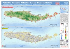
Tunami Affected Areas of Choiseul Island Map
The map illustrates the areas 10m and below potentially affected by the tsunami on the coast of...
4509 miles away
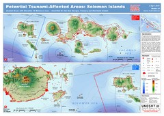
UNOSAT Solomon Islands Elevation Map
This map illustrates those areas 10 meters and less in elevation (marked in red) potentially...
4780 miles away
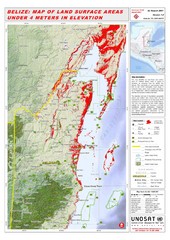
Belize Land Surface Areas Under 4 Meters Map
This map shows elevation areas in Belize under 4 meters in Red. This was the limit for the storm...
10104 miles away


 Explore Maps
 Map Directory
