Cyclone Nargis Affected Area Map
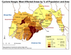
Cyclone Nargis Vulnerability Estimates by Township
0 miles away
Near bengal bay
3300 × 2550•2.3 MB•JPG

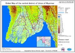
Elevation Map Central Distrisct of Union of...
The map shows topography of the Ayeyarwady (Irrawady) Delta and the Sittoung (Sittang) Delta, that...
52 miles away
Near Pyapon
3507 × 2482•575 KB•PNG

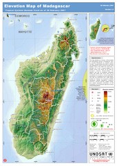
Madagascar Elevation Map
Shows color-coded elevation of island of Madagascar. Shows tropical cyclone Gamede track as of Feb...
4109 miles away
Near Madagascar
2924 × 4133•1.5 MB•JPEG

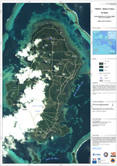
Wallis Cyclone Map
Shows zones of Wallis Island affected by cyclone Tomas in March 2010
6375 miles away
Near Wallis Island
3508 × 4967•2.3 MB•JPG
page 1 of 1


 Explore Maps
 Map Directory
