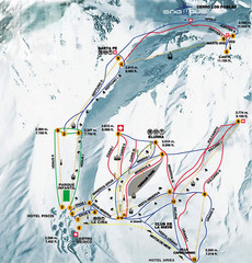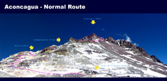
Aconcagua Normal Route Map
Shows the normal climbing route up Aconcagua, at 22,841 ft the highest mountain in the Americas and...
0 miles away
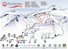
Mapa de Los Penitentes Map
Ski trail map
17 miles away
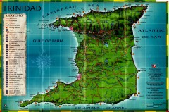
Trinidad tourist map
Trinidad tourist map. Shows points of interest.
3036 miles away
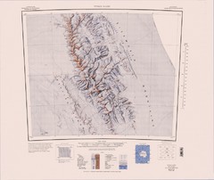
Vinson Massif Topo Map
Topo map of Vinson Massif, the highest mountain in Antarctica at 16067 ft / 4897 m. One of the...
3186 miles away
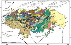
Honduras Geology Map
3479 miles away

Ames Range Topo Map
Topo relief map of the Ames range in western Marie Byrd Land, Antarctica. Shows Mt. Andrus 9,770...
3578 miles away
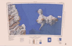
Ross Island Topo Map
Topo map of Ross Island, Antarctica. Shows US Mcmurdo Station, New Zealand Scott Base and volcanic...
4481 miles away
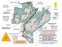
Davidson-Arabia Mountain Nature Preserve Map
Davidson-Arabia Mountain Nature Preserve is comprised of 570 acres of granite outcrop, wetlands...
4678 miles away

Waynesville and Lake Junaluska Panoramic Map
Panoramic Map taking in Waynesville, Lake Junaluska and the Richland Creek watershed in Haywood...
4787 miles away
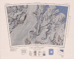
The Cloudmaker Topo Map
Topo map of region surrounding The Cloudmaker mountain and the Beardmore Glacier. 1:250,000 scale.
4839 miles away
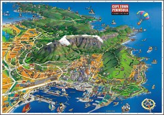
Cape Town Bird's Eye View Map
Bird's eye view tourist map of Cape Town and peninsula, South Africa.
4932 miles away
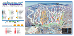
Camelback Ski Trail Map
Ski trail map of Camelback ski area
5108 miles away
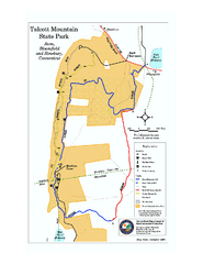
Talcott Mountain State Park map
Trail map of Talcott Mountain State Park in Connecticut.
5154 miles away
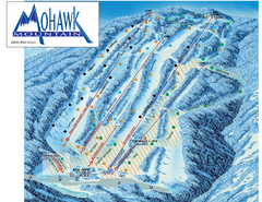
Mohawk Mountain Ski Trail Map
Ski trail map of Mohawk Mountain ski area
5155 miles away
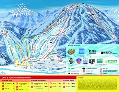
Hunter Mountain Trail Map
5184 miles away
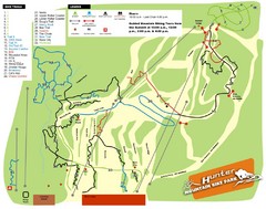
Hunter Mountain Bike Park Map
Map of bike trails in park
5186 miles away
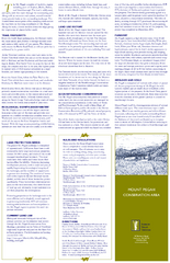
Mt. Pisgah Map - Northboro, Berlin, Boylston Mass
5189 miles away
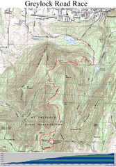
Mt. Greylock Road Race Course Map
Course map of the annual Mount Greylock Road Race. 8 Miles (uphill). Start/Finish: Mt. Williams...
5212 miles away
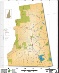
Temple NH Topo Map
Topographical map of Temple, NH area. Shows all roads and points of interest.
5221 miles away
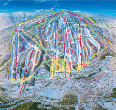
Mount Snow Ski Trail Map - main face
Trail map of main face of Mt Snow ski area near Wilmington, Vermont
5232 miles away
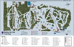
Buffalo Ski Club Trail Map
5239 miles away
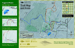
Equinox Preservation Trail map
Trail map of the Equinox Preservation Trust in Manchester, VT. The Equinox Preservation is over...
5247 miles away
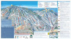
Okemo Ski Trail Map
Ski trail map of Okemo ski area. A James Niehues creation.
5263 miles away
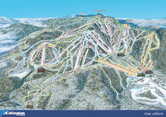
Killington Ski Trail Map 2008
Ski trail map of Killington ski area as of 2008
5277 miles away
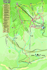
Killington Hiking Trail Map
Hiking trail map of Killington Ski Area summer trails. Shows life zones and geologic features.
5277 miles away
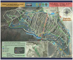
Pajarito Mountain Summer Bike Hike Trail Map
Pajarito Ski Area offers summer bike and hike lift service weekends. When lifts are not running...
5293 miles away
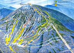
Sugarloaf Mountain Trail Map
Ski trail map
5294 miles away
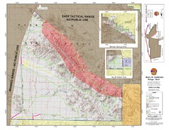
Barry M. Goldwater Range Topographical Map
Map showing detailed information about the Barry M. Goldwater Range, Sauceda and Sand Tank...
5307 miles away
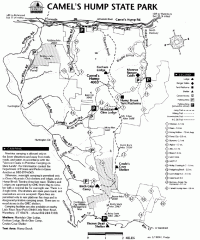
Camel's Hump State Park map
Map of Camel's Hump State Park, Vermont. Shows all hiking, snowmobile, and X-C ski trails...
5328 miles away
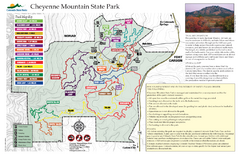
Cheyenne Mountain State Park Map
Trail map of park
5420 miles away
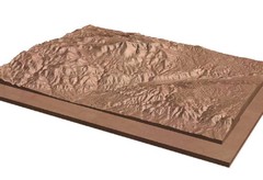
Pikes Peak, Colorado carved by CarvedMaps.com Map
Pikes Peak in Colorado has been carved by CarvedMaps.com This company can carve anywhere within...
5431 miles away
Palomar Mountain State Park Trail Map
Map of doane valley trail in park
5490 miles away
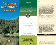
Palomar Mountain State Park Map
Map of park with detail of trails and recreation zones
5490 miles away
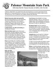
Palomar Mountain State Park Campground Map
Map of campground region of park with detail of trails and recreation zones
5490 miles away
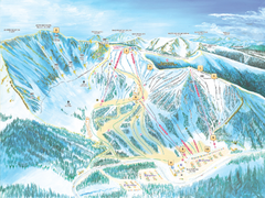
Arapahoe Basin Ski Trail Map 2007
Ski trail map of Arapahoe Basin ski area
5501 miles away
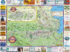
Frisco, CO Resort Map
Resort Maps of Summit County is the most widely distributed map in Frisco, Copper Mountain...
5504 miles away
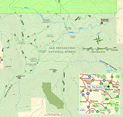
Mount San Jacinto State Park SE Map
Map of SE region of park with detail of trails and recreation zones
5507 miles away
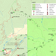
Mount San Jacinto State Park NW Map
Map of NW region of park with detail of trails and recreation zones
5507 miles away
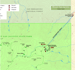
Mount San Jacinto State Park NE Map
Map of NE region of park with detail of trails and recreation zones
5507 miles away


 Explore Maps
 Map Directory
