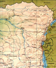
Zaire (Eastern Region) Map
Eastern Zaire (now Democratic Republic of the Congo)
0 miles away
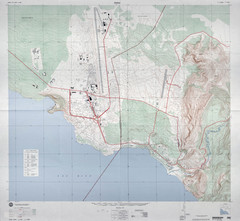
Goma Map
Goma, Democratic Republic of the Congo • original scale 1:7,500, Edition 3-DMA, Series Z091.
135 miles away
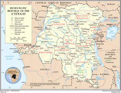
Democratic Republic of Congo Map
Overview map of the Democratic Republic of Congo (DRC).
438 miles away
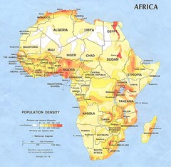
Africa Population Map
Map of population densities throughout Africa
606 miles away
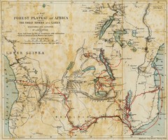
Forest Plateau of Africa Map
A historical Map of the Forest Plateau of Africa. Includes rivers, lakes, cities, and the route of...
639 miles away
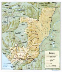
Congo Physical Relief Map
Physical relief map of the Republic of the Congo. Shows major roads and cities.
801 miles away
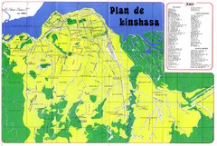
Kinshasa Overview Map
Overview map of Kinshasa, Democratic Republic of Congo shows major streets.
863 miles away
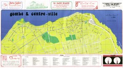
Kinshasa Gombe and Centreville Tourist Map
Tourist map of Gombe and Centreville in Kinshasa. Shows streets and points of interest. In French...
863 miles away
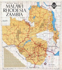
Malawi, Rhodesia and Zambia Road Map
Road map to the southern countries of Africa
1012 miles away
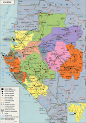
Gabon Regional Map
Guide to the regions of Gabon
1043 miles away
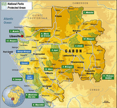
Gabon National Park Map
Guide to the national parks of Gabon in Africa
1074 miles away


 Explore Maps
 Map Directory
