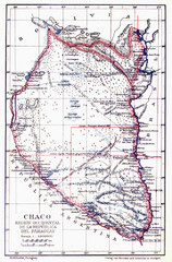
All the failed proposals to delimit the Chaco Map
Here you can see all the proposals to delimit the Chaco between 1879 and 1894. Everyone of them...
0 miles away
Near Paraguay
1306 × 1981•1.5 MB•JPG
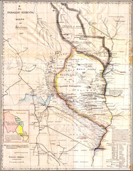
Wartime map of the Chaco
This 1933 map of the Chaco was made during the Chaco War between Paraguay and Bolivia and used by...
0 miles away
Near Paraguay
1932 × 2480•2.7 MB•JPG
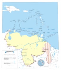
Official boundaries of Venezuela Map
All the official boundaries of Venezuela including the maritime ones.
2138 miles away
Near Venezuela
2481 × 2884•524 KB•JPG
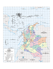
Official boundaries of Colombia Map
All the official boundaries of Colombia including the maritime ones.
2210 miles away
Near Colombia
605 KB•PDF
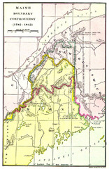
Maine Boundary Controversy 1782-1842 Map
Here you can all the British and American claims and proposals to settle the Maine boundary with...
4793 miles away
Near Maine
949 × 1461•758 KB•JPG
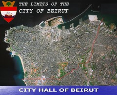
Beruit City Limits Map
Aerial map of city of Beruit, Lebanon showing city limits
7327 miles away
Near Beruit, Lebanon
2478 × 2028•801 KB•JPG
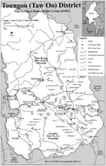
Toungoo District Map
Geographic map of Toungoo District of Burma
10803 miles away
Near Toungoo, Burma
1268 × 1969•243 KB•JPG
page 1 of 1


 Explore Maps
 Map Directory
