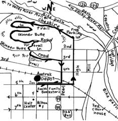
Eugene Oregon Walk, Skinner Butte and River Path...
Walk on the Willamette River Bike path, up Skinner Butte on a forest path and through a historic...
0 miles away
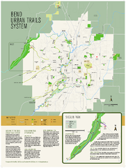
Bend urban trails system Map
The Bend Urban Trail System currently includes approximately 48 developed miles of trails which...
88 miles away

Bear Creek Greenway Map
Trail map of the Bear Creek Greenway connecting Central Point to Ashland, Oregon. Will eventually...
120 miles away
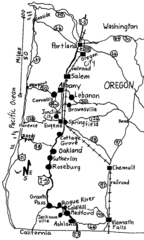
Oregon Walks Map
Walks in Portland, Oregon City, Corvallis, Salem, Lebanon, Albany, Eugene, Springfield, Junction...
158 miles away
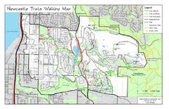
Newcastle Trails Trail Map
Trail map of existing and proposed trails in Newcastle, WA
244 miles away
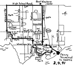
Bainbridge Walking Map
From Seattle Ferry Terminal, take the Bainbridge Ferry to Winslow. The walk is 4 miles with...
249 miles away
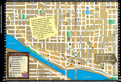
Fremont Walking Tour Map
Walking tour map of Fremont Washington in city of Seattle. Center of the known universe. Shows...
251 miles away
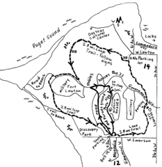
Discovery Park Walking Map Seattle Map
You can walk the Historic Parade Grounds in Fort Lawton (1.5 miles) and/or the 2.8 mile Trail Loop...
251 miles away
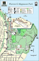
Warren G. Magnuson Park Map
Map of Warren G. Magnuson Park Warren G. Magnuson Park sits on a splendid mile-long stretch of...
254 miles away
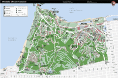
Presidio of San Francisco detail map
Detail map of the Presidio of San Francisco from NPS. Shows hiking/walking trails and POIs such as...
434 miles away
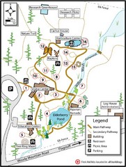
Flagstaff Arboretum Map
863 miles away
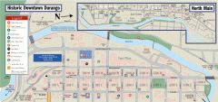
Historic Downtown Durango map
Walking map of historic downtown Durango, Colorado. Sponsored by the Durango Business Improvement...
924 miles away
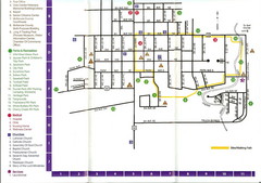
Watford City Map
Map of Watford City, McKenzie County, North Dakota. Includes streets, important buildings, parks...
985 miles away
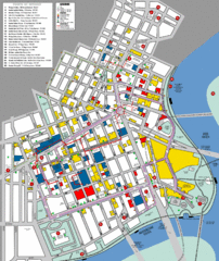
Winnipeg Parking and Walking Map
Shows parking facilities and walking points of interest in downtown Winnipeg, Manitoba, Canada.
1282 miles away
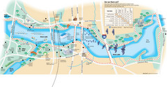
Town Lake Map
Mape of Town Lake and surrounding area, with detail on walking trails
1682 miles away

Panola Mountain State Park Map
Map of park with detail of trails and recreation zones
2194 miles away
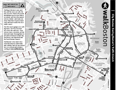
Walking Map of Boston, Massachusetts
Tourist map of Boston, Massachusetts, showing walking routes and times, as well as museums, squares...
2582 miles away
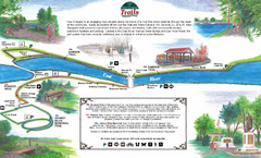
New Glasglow Town Trail Map
Walking trail map of trails in New Glasglow, Nova Scotia. Shows 3 trails: Samson Trail, Pioneer...
2895 miles away
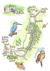
A walk around Bolton Abbey Yorkshire Map
A walk around Bolton Abbey in Yorkshire, Uk. Produced for Dales Life Magazine.
4834 miles away
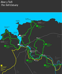
Cardigan Walks Map
Trail map of 6 circular walks in the Cardigan area ranging between four and a half and six and a...
4855 miles away
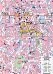
Ghent Walking Tour Map
Tourist and walking tour map of Ghent, Belgium. Shows points of interest.
5141 miles away
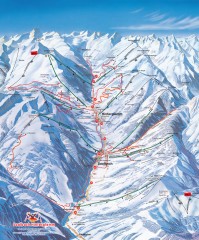
Saalbach and Hinterglemm Winter walks map
Panoramic map showing winter walks in the Saalbach and Hinterglemm Austria area.
5575 miles away
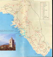
Tellaro Trail Map
Trail map showing marked and unmarked paths and other tourist points of interest. In English.
5703 miles away
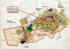
Fez Medina Walking Route Map
Photo of sign of walking routes in medina of Fez, Morocco.
5793 miles away
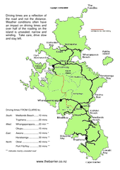
Great Barrier Island Map
On this website you will find comprehensive information about Great Barrier Island including all...
6757 miles away
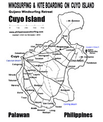
Cuyo Island Palawan Philippine Map
Cuyo is part of a group of 45 islets known as Quiniluban. It lies south of Mindoro and between...
6930 miles away
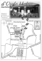
d` Oude Molen Guest House Map
d` Oude Molen Guest House Self Catering BnB Accommodation Family rooms
10402 miles away


 Explore Maps
 Map Directory
