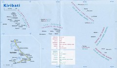
Kiribati Overview Map
Overview map of Pacific country of Kiribati. Kiribati is a Micronesian country made up of 33 low...
0 miles away
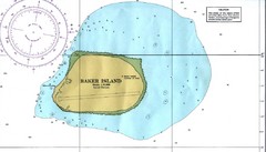
Baker Island Nautical Map
Nautical map of US unincorporated territory of Baker Island.
413 miles away
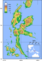
Halmahera Topography Map
Shows color coded shaded relief of island of Halmahera, Indonesia.
4253 miles away
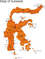
Sulawesi Overview Map
Overview map of island of Sulawesi, Indonesia. Shows major towns and airports.
4654 miles away
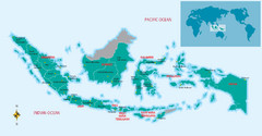
Indonesia Overview map
Shows regions of Indonesia and inset map shows Indonesia in context of rest of world.
5214 miles away
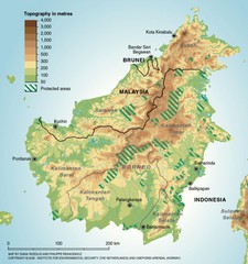
Borneo Protected Areas Map
Physical map of island of Borneo, Indonesia showing protected areas. Shows topography in meters.
5216 miles away
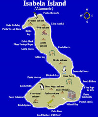
Isla Isabela Tourist Map
Tourist map of Isla Isabela in the Galapagos, Ecuador. Shows coastal features and wildlife.
5498 miles away
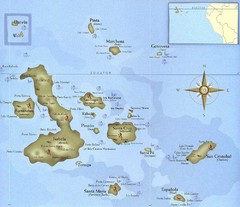
Galapagos Islands Tourist Map
Tourist map of the Galapagos Islands, Ecuador. Shows recreational activity locations.
5555 miles away
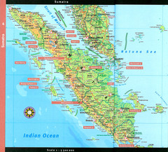
Sumatra Overview Map
Detailed map of island of Sumatra, Indonesia. Scanned.
6134 miles away
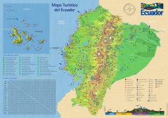
Ecuador Tourist Map
Detailed tourist map of Ecuador with inset of the Galapagos Islands. Shows National Parks and...
6318 miles away
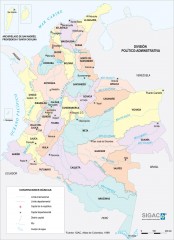
Colombia Political Map
Political map of Colombia. Shows departamental capitals. In Spanish.
6672 miles away
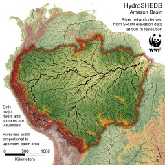
Amazon Basin Hydrosheds Map
Hydrosheds of the Amazon River Basin, the area drained by the Amazon River and its tributaries...
7708 miles away

Amazon River Map
Old map of the Amazon River and major tributaries.
7820 miles away

Maldives Overview Map
Overview map of the Maldives Islands in the Indian Ocean. Shows all atolls, towns/cities with...
8025 miles away
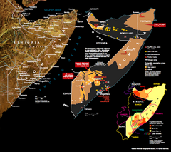
Somalia Conflict Map 2002
Shows conflict related information in Somalia from 2001-2002.
9893 miles away
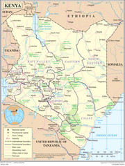
Kenya Overview Map
Overview map of Kenya. Shows major cities, roads, and national parks.
10471 miles away
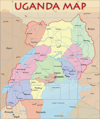
Uganda Political Map
Political map of Uganda. Shows regions, cities, and water features.
10861 miles away
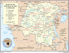
Democratic Republic of Congo Map
Overview map of the Democratic Republic of Congo (DRC).
11516 miles away
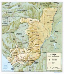
Congo Physical Relief Map
Physical relief map of the Republic of the Congo. Shows major roads and cities.
11989 miles away
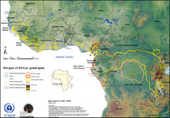
African Great Apes Habitat Range Map
Shows habitat ranges of chimpanzees, bonobos, and gorillas
12217 miles away
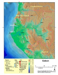
Gabon Shaded Relief Map
Shaded relief map of Gabon. Shows airports, railroads, roads, and cities.
12238 miles away
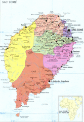
Sao Tome Political Map
Political map of island of São Tomé, lying on the equator off the west coast of...
12250 miles away


 Explore Maps
 Map Directory
