
1895 San Francisco Bay Area Map
Guide to the San Francisco Bay Area in 1895
35 miles away
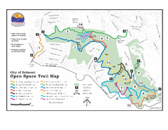
Water Dog Lake Park Trail Map
Trail map of Water Dog Lake Park. Open to mountain biking.
35 miles away

Pacheco State Park Map
Map of park with detail of trails and recreation zones
36 miles away
San Juan Bautista State Historic Park Map
Map of park with detail of trails and recreation zones
36 miles away
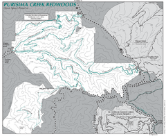
Purisima Open Space Preserve Map
Trail map of Purisima Open Space Preserve. Shows all mountain biking, hiking, and horseback riding...
36 miles away
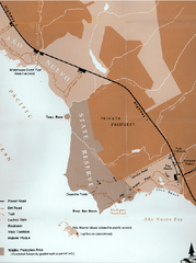
Ano Nuevo State Park Map
Map of park with detail of trails and recreation zones
37 miles away

Ano Nuevo State Park Map
Map of park with detail of trails and recreation zones
37 miles away
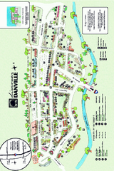
Walking Map of Downtown Danville, California
Tourist walking map of downtown Danville, California. Shows restaurants, shops, visitor's...
37 miles away
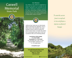
Caswell Memorial State Park Map
Map of park with detail of trails and recreation zones
37 miles away
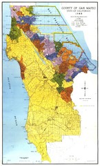
San Mateo County Map
Official county map of San Mateo, California. Scale 1"=5000'
37 miles away

San Mateo County Mid-County Trail Map
Trail map of mid-county trails in San Mateo County, California.
38 miles away
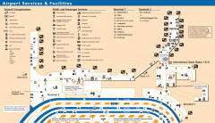
Oakland International Airport (OAK) Map
Terminal map. Shows all airport services and facilities
38 miles away
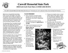
Caswell Memorial State Park Campground Map
Map of park with detail of trails and recreation zones
38 miles away
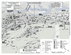
Anthony Chabot Regional Park Map - North
Trail map of the north section of Anthony Chabot Regional Park in the East Bay Hills.
39 miles away
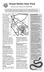
Mount Diablo State Park Campground Map
Map of park with detail of trails and recreation zones
39 miles away
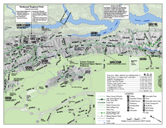
Leona Canyon Regional Open Space Preserve Map
39 miles away
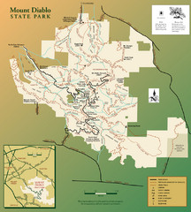
Mt. Diablo State Park Map
Trail map of Mt. Diablo State Park near Walnut Creek, CA
39 miles away

San Luis Reservoir State Recreation Area Map
Map of park and reservoir with detail of trails and recreation zones
39 miles away
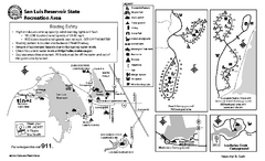
San Luis Reservoir State Recreation Area...
Map of campground region of park and reservoir with detail of trails and recreation zones
39 miles away
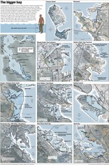
San Francisco Sea Level Rise Map
Guide to the San Francisco Bay Area, and the areas that will be underwater if there is a 1 meter...
39 miles away
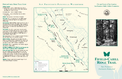
Fifield-Cahill Ridge Trail Map
Trail map and brochure of the Fifield-Cahill Ridge Trail in the San Francisco Peninsula Watershed.
40 miles away
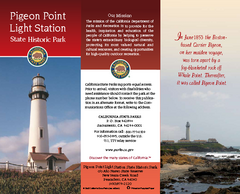
Pigeon Point Light Station State Historic Park Map
Map of park with detail of trails and recreation zones
40 miles away
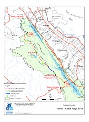
Fifield-Cahill Ridge Trail Map
Trail map of the Fifield-Cahill Ridge Trail in the San Francisco Peninsula Watershed.
41 miles away
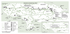
Redwood Regional Park Map
Trail map of Redwood Regional Park in Oakland, California. Shows hiking, horse, and bike trails.
41 miles away
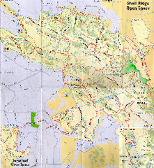
Shell Ridge Open Space Trail Map
Trail map of Shell Ridge Open Space, Walnut Creek's largest open space unit, with trails for...
42 miles away
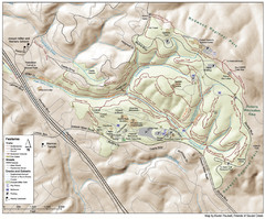
Joaquin Miller Park Map
Trail map of Joaquin Miller Park in Oakland, California. 500 acre park 9 miles from downtown...
42 miles away

Fremont Peak State Park Map
Map of park with detail of trails and recreation zones
42 miles away
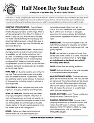
Half Moon Bay State Beach Campground Map
Map of beach with detail of trails and recreation zones
42 miles away
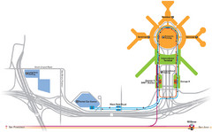
San Francisco International Airport Map
42 miles away
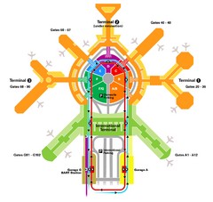
San Francisco Initernational Airport SFO Terminal...
AirTrain, airline, and gate locations map of SFO.
42 miles away
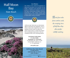
Half Moon Bay State Beach Map
Map of beach with detail of trails and recreation zones
42 miles away
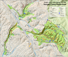
Sausal Creek Watershed Trail Map
Trail map of the Sausal Creek Watershed in Oakland, California. Show trails in Joaquin Miller Park...
43 miles away
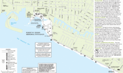
Crown Memorial State Beach Map
43 miles away
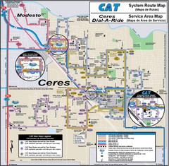
Ceres, CA Transportation Map
44 miles away
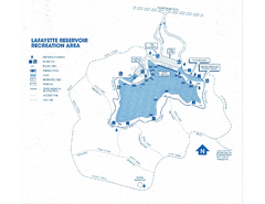
Lafayette Reservoir Recreation Area Map
44 miles away

Downtown Oakland, California Map
Tourist map of downtown Oakland, California. Shows museums, parks, neighborhoods of interest and...
44 miles away
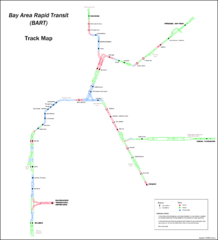
Bay Area Rapid Transit (BART) Track Map
Map of Bay Area Rapid Transit (BART) tracks. Includes all train stops and details about the tracks.
45 miles away
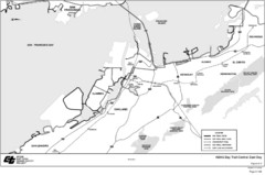
Bay Area, CA Bike Map
45 miles away
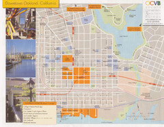
Oakland Tourist Map
Tourist map of downtown Oakland, California. Shows shopping districts.
45 miles away
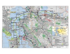
San Francisco Trans Bay Cable Project EIR Map
Map A.2-1 Detailed Project Location
45 miles away

