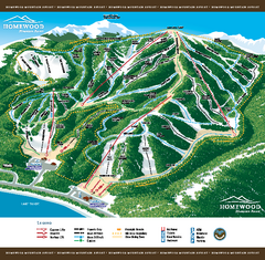
Homewood Mountain Resort Ski Trail Map
Trail map from Homewood Mountain Resort, which provides downhill and terrain park skiing. It has 7...
174 miles away
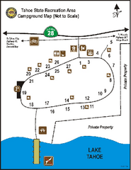
Tahoe State Recreation Area Campground Map
Map of park with detail of trails and recreation zones
174 miles away

Millerton Lake State Recreation Area NE Map
Map of NE region of park with detail of trails and recreation zones
174 miles away
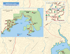
Millerton Lake State Recreation Area NW Map
Map of NW region of park with detail of trails and recreation zones
174 miles away
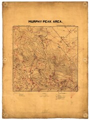
Murphy Peak Area Survey Map
Topographic geology map of Murphy Peak area, California. L.S.J.U. Geological Survey, 1911...
174 miles away
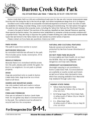
Burton Creek State Park Map
Map of park with detail of trails and recreation zones
174 miles away
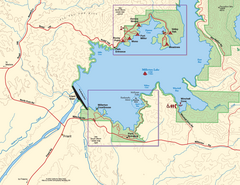
Millerton Lake State Recreation Area SW Map
Map of SW region of park with detail of trails and recreation zones
175 miles away
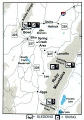
Skiing and Sledding in Elko County, Nevada Map
Map of skiing and sledding opportunities in Elko County, Nevada, showing skiing and sledding...
175 miles away
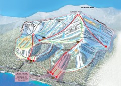
Homewood Ski Trail Map
Official ski trail map of Homewood ski area from the 2007-2008 season.
175 miles away
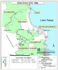
West Shore Lake Tahoe Off-highway Vehicle Map
Off-highway vehicle map of the West Shore of Lake Tahoe. Roads open to motorcycles, ATVs, and 4x4s...
175 miles away

Millerton Lake State Recreation Area Park Map
Map of park with detail of trails and recreation zones
175 miles away
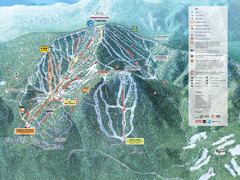
Northstar-at-Tahoe Ski Trail Map
Official trail map of Northstar-at-Tahoe ski area from the 2009-2010 season
175 miles away
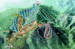
Northstar Ski Trail Map
Official ski trail map of Northstar-at-Tahoe ski area from the 2007-2008 season.
175 miles away
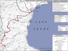
Tahoe Rim Trail: Barker Pass to Tahoe City Map
Topographic hiking map of the Barker Pass-Tahoe City leg of the Tahoe Rim Trail. Shows trailheads...
176 miles away
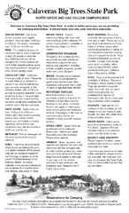
Calaveras Big Trees State Park Map
Map of park with detail of trails and recreation zones
177 miles away
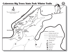
Calaveras Big Trees State Park Winter Map
Map of park with detail of winter ski trails and recreation zones
177 miles away
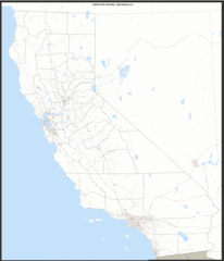
California Zip Code Map
Check out this Zip code map and every other state and county zip code map zipcodeguy.com.
177 miles away
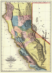
1851 California Regional Map
Great quality map of Californian regions in 1851.
177 miles away
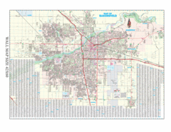
Bakersfield, California City Map
177 miles away
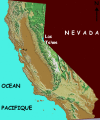
California elevation Map
California map showing elevations by contours, with Lake Tahoe identified.
177 miles away
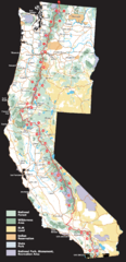
Pacific Crest Trail Route Overview Map
Western United States Map showing National Forests, State Parks, National Parks, Indian...
177 miles away
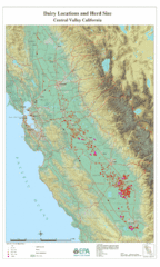
Dairy Locations and Herd Size for the Central...
Map of dairy locations, displayed by herd size in California's Central Valley. Base map...
177 miles away

California Counties Map
178 miles away
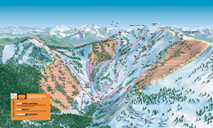
Alpine Meadows Ski Trail Map (Front)
Official ski trail map of Alpine Meadows ski area from the 2005-2006 season.
179 miles away

Relative Motion of Pacific and North American...
Diagram illustrating the plate-tectonic setting of southern California (image source: USGS general...
179 miles away
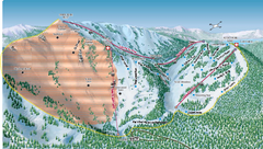
Alpine Meadows Ski Area Backside Ski Trail Map
Trail map from Alpine Meadows Ski Area, which provides downhill and terrain park skiing. It has 13...
179 miles away
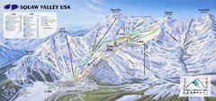
Squaw Valley USA Ski Trail Map
Trail map from Squaw Valley USA, which provides downhill, night, nordic, and terrain park skiing...
180 miles away
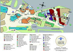
Squaw Valley Base Village Map
Village map of base of Squaw Valley Ski Resort, Lake Tahoe, California. Shows all restaurants...
180 miles away
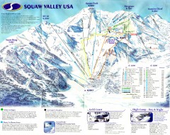
Squaw Valley Ski Trail Map
Scan of ski trail map of Squaw Valley ski area from the 2000-2001 season.
180 miles away
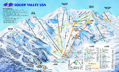
Squaw Valley USA Trail Map
Trail map of Squaw Valley ski area in Lake Tahoe, California
181 miles away
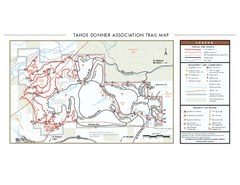
Tahoe Donner Ski Trail Map
Official ski trail map of Tahoe Donner Association. Shows both downhill and cross-country ski...
181 miles away
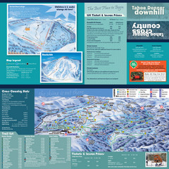
Tahoe Donner Cross Country Ski Trail Map
Ski trail map of Tahoe Donner Association. Shows both downhill and cross-country ski trails...
182 miles away
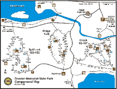
Donner Memorial State Park Campground Map
Map of park with detail of trails and recreation zones
182 miles away
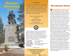
Donner Memorial State Park Map
Map of park with detail of trails and recreation zones
182 miles away
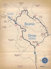
Red Rock Canyon Trail Map
Hiking trail map
183 miles away

Tahoe Donner Ski Trail Map
Trail map from Tahoe Donner, which provides downhill, night, and nordic skiing. It has 3 lifts...
184 miles away

Granite Chief Wilderness Map
Trail map of Granite Chief Wilderness in Lake Tahoe region. Shows trails (inlcuding Pacific Crest...
185 miles away

Snowmobiling Map, Elko County, Nevada
Map of snowmobiling opportunities in Elko County, Nevada. Snowmobiling areas, roads, and towns are...
186 miles away
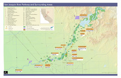
San Joaquin River Parkway Map
Map of the San Joaquin River Parkway. "The San Joaquin River Parkway is a mosaic of parks...
186 miles away
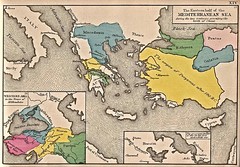
Historical Map of Mediterranean Sea B.C. 1884
"The Eastern half of the Mediterranean Sea during the two centuries preceeding the birth of...
186 miles away

