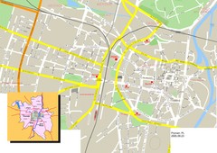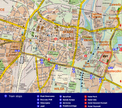
Poznan City Map
City map of Poznan with Tram stops and hotels
100 miles away
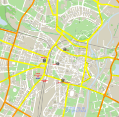
Poznan Street Map
Street map of Poznan, Poland.
100 miles away
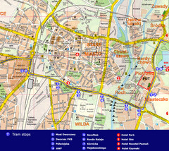
Poznan Tourist Map
Tourist map of central Poznan, Poland. Shows tram stops, hotels, and other points of interest.
100 miles away
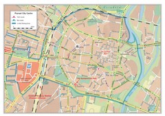
Poznan City Map
City map of center of Poznan, Poland. Shows bus and tram routes.
100 miles away
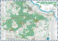
PuszczaKozienicka tourist map
LKP - Lesny Kompleks Promocyjny - PuszczaKozienicka - tourist map Ed. 2010 Projection: UTM/WGS84...
103 miles away
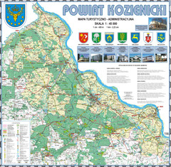
Kozienice_County_wall_map Map
Kozienice County big size wall map Covers all 7 communes: Kozienice, Garbatka-Letnisko, Grabow nad...
104 miles away
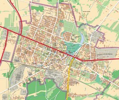
Mińsk Mazowiecki City Map
City map of Mińsk Mazowiecki, Poland
105 miles away
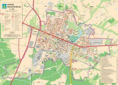
Minsk Tourist Map
Tourist map of Minsk, Poland. In Polish.
105 miles away
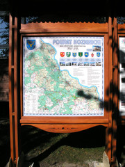
Kozienice_County_Poland_Streetmap.jpg Map
Street Map of Kozienice_County_Poland_Streetmap.jpg is added here because of the interesting wooden...
106 miles away
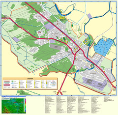
Kocienice_City_Plan-POLAND Map
Plan of City of Kozienice, PL
106 miles away
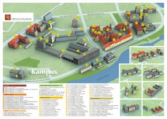
Wroclaw University of Technology Campus Map
106 miles away
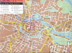
Wroclaw Tourist Map
Tourist map of central Wrocław, Poland. Shows points of interest.
107 miles away
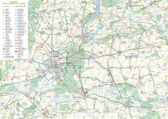
mapa rowerowa okolice leszna Map
109 miles away
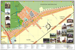
Garbatka_Letnisko_Poland.jpg Map
Map of Garbatka_Letnisko_Poland.jpg is a "city-village" plan. I do love to enter photos...
111 miles away
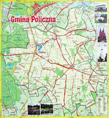
Policzna Commune Street Map
POLICZNA Commune, street map Ed. 2008 Size 2000 x 1250 mm Waterproof print-out verified for...
111 miles away
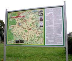
Policzna_Zwolen_Poland.jpg Map
Map of Policzna_Zwolen_Poland.jpg is another "all-proof" street map. 5 years on site...
112 miles away
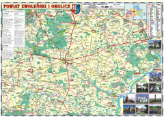
Zwolen_county_folded_map_POLAND Map
Zwolen county, paper folded map Scale 1: 70 000 Projection UTM/WGS84, GPS compatibile verified...
112 miles away
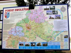
Zwolen county street map
Zwolen county - street map Big size 200 x 300 cm waterproof map
112 miles away
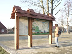
Sieciechow commune street map, PL Map
Sieciechow commune - street map Ed. 2007 Size 2000 x 1000 mm Type: administratie and touristic map
114 miles away
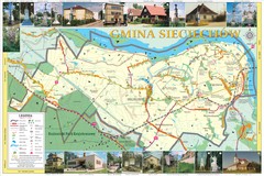
Sieciechow, Poland, Mazovia Map
Sieciechow commune map, Mazovia, PL
114 miles away
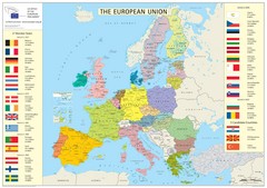
European Union Member States Map
Shows all member states and years joined. Also shows candidate states.
115 miles away
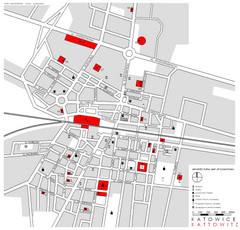
Kattowitz Tourist Map
Tourist map of Kattowitz, Poland. Shows points of interest.
115 miles away
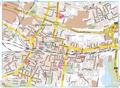
Katowice Tourist Map
Tourist map of central Katowice, Poland. Shows points of interest.
115 miles away
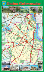
GNIEWOSZOW commune map, PL Map
Gniewoszow commune map Ed. 2007
118 miles away
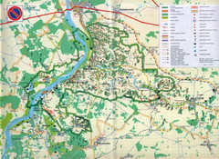
Kazimierski Landscape Park Map
Part of one of main ecological corridors in Europe enabling the birds to nest and migrate.
128 miles away
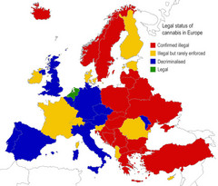
Legal Status of Cannabis in Europe Map
Shows legal status of marijuana in each European country.
129 miles away
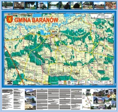
Baranow count wall map, PL Map
Baranow commune in Pulawy county, PL 3D big size wall map, surrounded by photos from Baranow area...
131 miles away
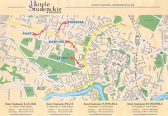
Cracow City Map
City map of Cracow with hotels
133 miles away
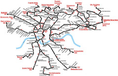
Krakow Bus Routes Map
133 miles away
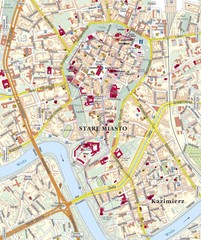
Krakow Tourist Map
133 miles away
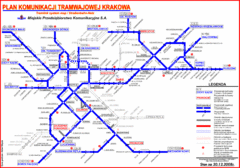
Cracow Tramlink Map (Polish)
133 miles away
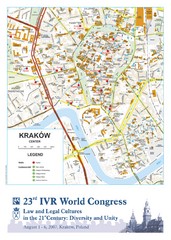
Krakow Map
Map of the city of Krakow. Includes streets, buildings, hotels, and parks.
133 miles away
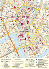
Krakow Tourist Map
Tourist map of central Krakow, Poland. Shows tourist routes and site of historic interest.
133 miles away
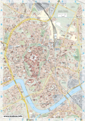
Krakow City Map
City map of central Krakow, Poland.
133 miles away
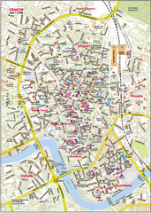
Krakow City Center Map
133 miles away
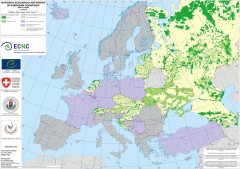
National Ecological Networks of European...
Shows core areas and ecological corridors in European countries with Ecological Network plans. By...
135 miles away
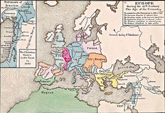
Old Map of Europe - 12th century
136 miles away
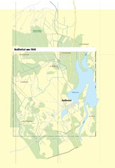
Naßlettel Map
141 miles away
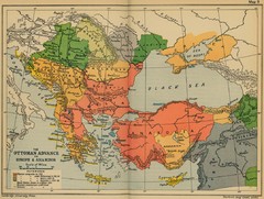
The Ottoman Advance of Europe and Asia Minor Map
142 miles away

