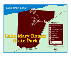
Lake Mary Ronan State Park Map
Off the beaten path just seven miles west of Flathead Lake, this park is shaded by Douglas fir and...
1009 miles away
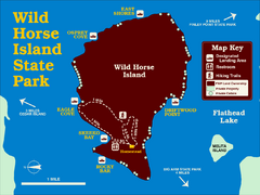
Wild Horse Island State Park Map
Boat access to this day-use-only, primitive park is regulated to protect the 2,000-acre island. The...
1013 miles away

Pacific Northwest Inside Passage Map
Amazing Pacific Northwest Inside Passage Legendary map.
1013 miles away
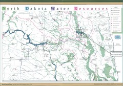
North Dakota Water Resources Map
North Dakota Counties, Rivers and Lakes Map
1014 miles away
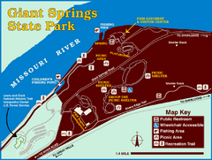
Giant Springs State Park Map
Set aside a whole afternoon to experience this scenic and historic freshwater springs site. First...
1014 miles away
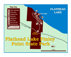
Finley Point State Park Map
This park is located in a secluded, mature pine forest near the south end of Flathead Lake. Enjoy...
1017 miles away
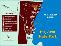
Big Arm State Park Map
Clear map and map key of Park camping grounds.
1017 miles away
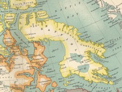
Baffin Island Map
1017 miles away
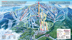
49 North Mountain Resort Ski Trail Map
Trail map from 49 North Mountain Resort, which provides downhill, night, nordic, and terrain park...
1020 miles away
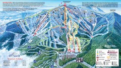
49 Degrees North Ski Trail Map
Official ski trail map of ski area from the 2007-2008 season.
1021 miles away
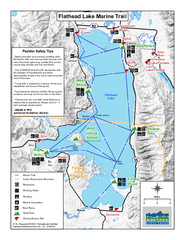
West Shore State Park Map
Glacially carved rock outcrops rise from Flathead Lake to overlooks with spectacular views of the...
1021 miles away
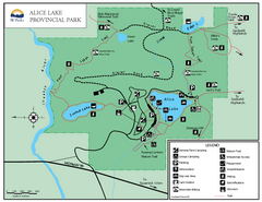
Alice Lake Provincal Park Map
1022 miles away
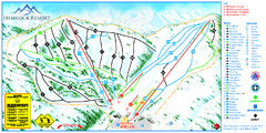
Hemlock Resort Ski Trail Map
Trail map from Hemlock Resort, which provides downhill and terrain park skiing. It has 4 lifts...
1024 miles away
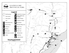
Golden Ears Provincial Park Map
Park map of Golden Ears Provincial Park, BC. 2 pages.
1024 miles away
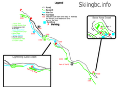
Manning Park Resort 2004–07 Manning Park...
Trail map from Manning Park Resort, which provides downhill and nordic skiing. It has 4 lifts...
1024 miles away
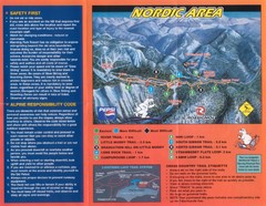
Manning Park Resort 2004–07 Manning Park Cross...
Trail map from Manning Park Resort, which provides downhill and nordic skiing. It has 4 lifts...
1024 miles away
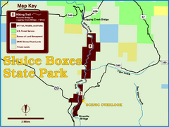
Sluice Boxes State Park Map
Remains of mines, a railroad, and historic cabins line Belt Creek as it winds through a beautiful...
1025 miles away
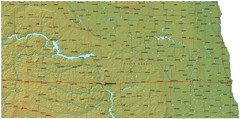
North Dakota Map
1026 miles away
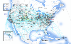
United Airlines North America Route Map
1026 miles away
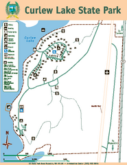
Curlew Lake State Park Map
Map of park with detail of trails and recreation zones
1029 miles away
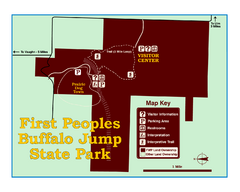
First People's Buffalo Jump State Park Map
A visitor center and interpretive trails tell the story of this prehistoric bison kill site, one of...
1029 miles away
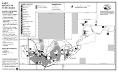
Lake Bronson State Park Summer Map
Summer seasonal map of park with detail of trails and recreation zones
1029 miles away
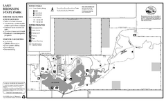
Lake Bronson State Park Winter Map
Winter seasonal map of park with detail of trails and recreation zones
1029 miles away
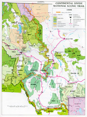
Continental Divide Scenic Trail Map
Guide to the Montana portion of the Continental Divide trail
1029 miles away
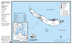
Garden Island State Recreation Area Map
Map of park with detail of trails and recreation zones
1031 miles away
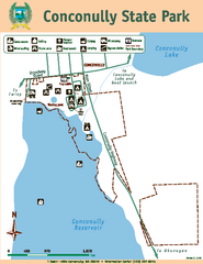
Conconully State Park Map
Map of park with detail of trails and recreation zones
1037 miles away
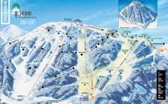
Mt. Spokane Ski Trail Map
Official ski trail map of Mount Spokane ski area from the 2006-2007 season.
1039 miles away
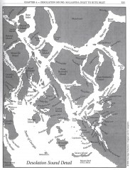
Desolation Sound Detail Map
Shows general geography of Desolation Sound from Malaspina Inlet to Bute Inlet. Shows Cortes Bay...
1039 miles away
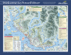
Upper Sunshine Coast Recreation Map
Recreation map of Upper Sunshine Coast in BC. Shows hiking trails, kayaking and canoeing routes...
1039 miles away
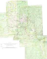
Mount Spokane Trail Map
Contour map of Mount Spokane
1039 miles away
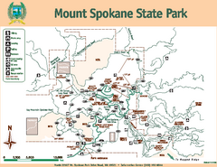
Mount Spokane State Park Map
Map of park with detail of trails and recreation zones
1039 miles away
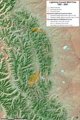
Montana Mountain Range Map
Fires on the Montana mountain range
1040 miles away
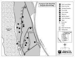
Thompson Falls State Park Map
This shaded, quiet campground is located on the Clark Fork River near the town of Thompson Falls in...
1041 miles away
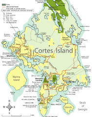
Cortes Island Tourist Map
Places of interest.
1043 miles away
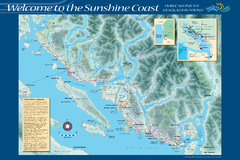
Sunshine Coast Recreation Map
Recreation map of the Sunshine Coast in BC. Shows trails for hiking (in yellow) and mountain...
1044 miles away
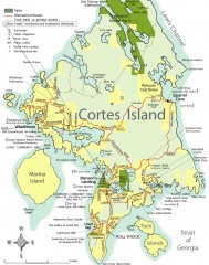
Cortes Island tourist map
Tourist map of Cortes Island in British Columbia, Canada. Shows businesses and roads.
1045 miles away
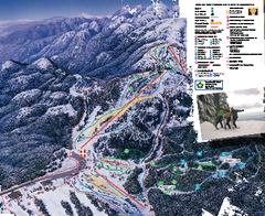
Mount Seymour Ski Trail Map
Trail map from Mount Seymour, which provides downhill, night, and terrain park skiing. It has 5...
1045 miles away
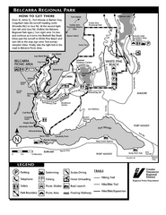
Belcarra Regional Park Trail Map
Trail map of Belcarra Regional Park, BC
1045 miles away
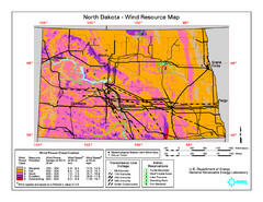
North Dakota Wind Resource Map
1046 miles away

