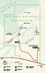
Big Hole National Battlefield Official Map
Official NPS map of Big Hole National Battlefield in Montana. Big Hole National Battlefield is...
1159 miles away
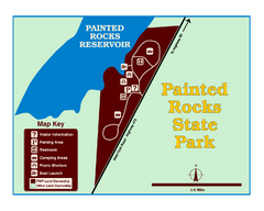
Painted Rocks State Park Map
Located in the scenic Bitterroot Mountains, this 23-acre park offers boating and water sport...
1160 miles away
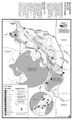
McCarthy Beach State Park Summer Map
Summer seasonal map of park with detail of trails and recreation zones
1160 miles away
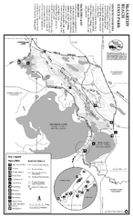
McCarthy Beach State Park Winter Map
Winter seasonal map of park with detail of trails and recreation zones
1160 miles away
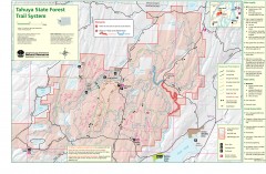
Tahuya State Forest Trail Map
Shows trails of Tahuya State Forest. Show roads, doubletrack, singletrack, and 4WD only.
1162 miles away
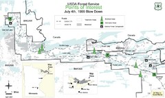
Quetico Provincial Park Map
BWCAW Visitors Map. Shows parameters of BWCAW areas, camp grounds, roads and information kiosks.
1162 miles away
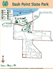
Dash Point State Park Map
Map of park with detail of trails and recreation zones
1162 miles away
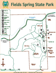
Fields Spring State Park Map
Map of park with detail of trails and recreation zones
1163 miles away
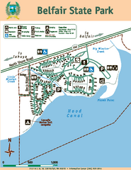
Belfair State Park Map
Map of park, with detail of trails and recreation zones
1164 miles away
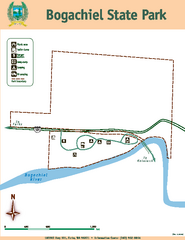
Bogachiel State Park Map
Map of park with detail of trails and recreation zones
1164 miles away
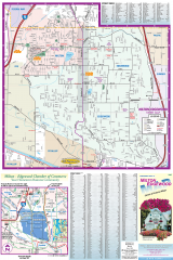
Milton and Edgewood tourist map
Tourist map of Milton and Edgewood, Washington. Shows all businesses.
1165 miles away
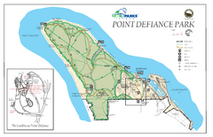
Point Defiance Park Map
1165 miles away

Milton tourist map
Tourist map of Milton, Washington. Shows all businesses.
1165 miles away
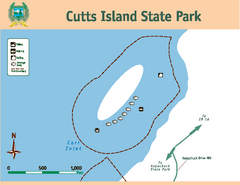
Cutts Island Stay Park Map
Map of park with detail of trails and recreation zones
1167 miles away

Tacoma, Washington City Map
1168 miles away
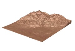
Emigrant Montana towards Baldy and Emigrant Peak...
Emigrant, MT towards Baldy and Emigrant Peak
1168 miles away
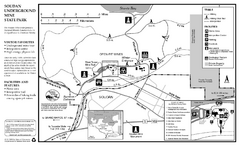
Soudan Underground Mine State Park Map
map of park with detail of trails and recreation zones
1168 miles away
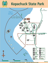
Kopachuck State Park Map
Map of island with detail of trails and recreation zones
1168 miles away
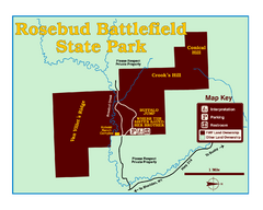
Rosebud Battlefield State Park Map
This National Historic Landmark on the rolling prairie of eastern Montana preserves the site of the...
1168 miles away
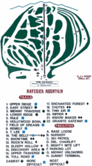
Maverick Mountain Ski Area Ski Trail Map
Trail map from Maverick Mountain Ski Area.
1168 miles away
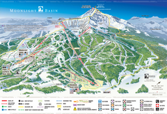
Moonlight Basin Ski Trail Map
Trail map from Moonlight Basin, which provides terrain park skiing. It has 8 lifts servicing 92...
1168 miles away
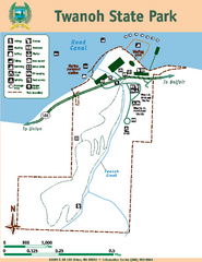
Twanoh State Park Map
Map of park with detail of trails and recreation zones
1170 miles away

Big Sky Resort Lone Peak Detail Ski Trail Map
Trail map from Big Sky Resort, which provides terrain park skiing. It has 21 lifts servicing 150...
1170 miles away
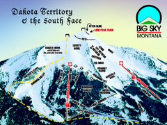
Big Sky Resort Dakota Territory Detail Ski Trail...
Trail map from Big Sky Resort, which provides terrain park skiing. It has 21 lifts servicing 150...
1170 miles away
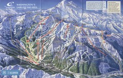
Crystal Mountain Resort Ski Trail Map
Trail map from Crystal Mountain Resort, which provides downhill skiing. It has 10 lifts servicing...
1170 miles away
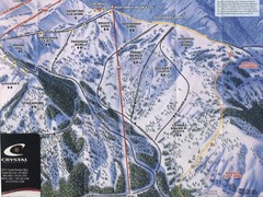
Crystal Mountain Resort Northway Inset Ski Trail...
Trail map from Crystal Mountain Resort, which provides downhill skiing. It has 10 lifts servicing...
1170 miles away
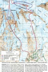
Mount Rainier Topo Map
Map of Mount Rainier Ascent. We ascended the "Muir Snowfield" and then went up the "...
1170 miles away
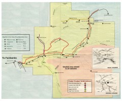
Chena River State Recreation Area map
Detailed map for Chena River State Recreation Area in Alaska
1170 miles away
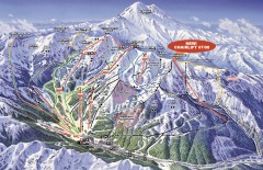
Crystal Mountain Ski Trail Map
Official ski trail map of Crystal Mountain ski area from the 2007-2008 season. 2600 acres of...
1171 miles away
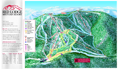
Red Lodge Mountain Ski Trail Map
Trail map from Red Lodge Mountain.
1171 miles away
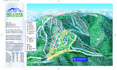
Red Lodge Mountain Ski Trail Map
Official ski trail map of Red Lodge Mountain ski area from the 2007-2008 season.
1171 miles away
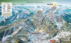
Big Sky Ski Resort Trail Map (Eastern exposure...
Big Sky ski resort trail map (Eastern exposure) for the 2006-2007 season
1171 miles away
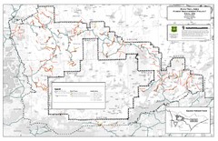
Superior National Forest Map
Echo Trail in Superior National Forest
1171 miles away
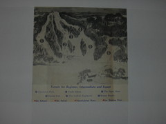
Val Chatel Ski Trail Map
Trail map from Val Chatel, which provides downhill and nordic skiing. This ski area opened in 1953.
1171 miles away

Big Sky Ski Resort Trail Map (Southern exposure...
Big Sky ski resort trail map (Southern exposure) for the 2006-2007 season. Also check out the...
1171 miles away
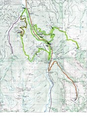
White River 50 Course Map
White River 50 Mile Trail Run
1171 miles away
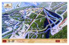
Spanish Peaks Resort Ski Trail Map
Trail map from Spanish Peaks Resort. It has 2 lifts servicing 12 runs; the longest run is 2574...
1172 miles away
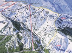
Crystal Mountain Ski Trail Map - Northway Area
Official ski trail map of the Northway area of Crystal Mountain ski area from the 2007-2008 season...
1172 miles away
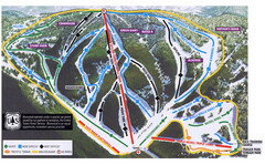
Bluewood Ski Trail Map
1172 miles away
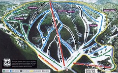
Bluewood Ski Trail Map
Trail map from Bluewood, which provides downhill, nordic, and terrain park skiing. It has 3 lifts...
1172 miles away

