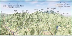
Panoramic Map of the Highlands of Roan (from TN)
Panoramic map of the Highlands of Roan as seen from Tennessee.
330 miles away

Roan Mountain Panorama Map
Panoramic Map of the View from the Baud Family Cabin of Roan Mountain, TN. The view overlooks...
330 miles away
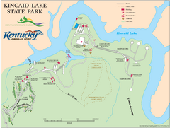
Kincaid Lake State Park Map
Map of trails, facilities and golf course in Kincaid Lake State Park.
331 miles away
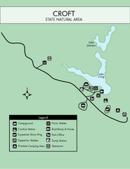
Croft State Park Map
Simple state park map.
331 miles away
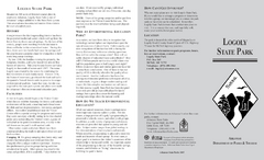
Logoly State Park Map
Map of Logoly State Park showing trails, park sites and amenities.
331 miles away

Abraham Balwin Agricultral College Campus Map
331 miles away
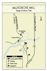
Musgrove Mill State Park Map
Clearly marked state park map.
331 miles away
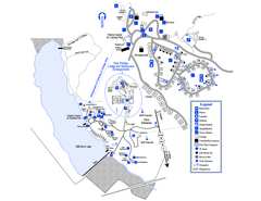
Little Ocmulgee State Park Map
Map of park with detail of trails and recreation zones
333 miles away
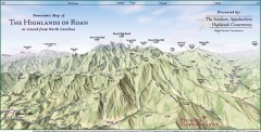
Panoramic Map of the Highlands of Roan (from NC)
Panoramic Map of the Roan Mountain Highlands as seen from North Carolina.
333 miles away
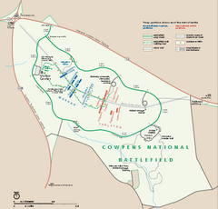
Cowpens National Battlefield Official Map
Official NPS map of Cowpens National Battlefield in South Carolina. Open 9:00 a.m. - 5:00 p.m...
333 miles away
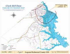
Richmond County Failure Inundation Map
Map of the flood water failure inundation of Augusta Richmond county, Georgia. Includes detailed...
335 miles away
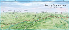
Panoramic View of Roan to Grandfather Map
This panorama takes in the vista from Roan to Grandfather mountain - overlooking the upper Linville...
335 miles away
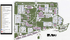
Augusta State University Map
Campus map
336 miles away
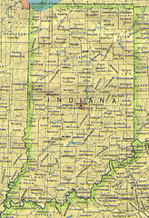
Indiana Map
336 miles away
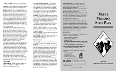
Mount Magazine State Park Map
Map of Mount Magazine State Park showing hiking trails and amenities.
338 miles away
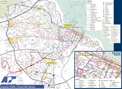
Augusta Public Transit Routes Map
Transit Route Map of the town of Augusta. Includes all streets, some important buildings, and a...
338 miles away

MCG Health System--Medical College of Georgia...
Color-coded map of all buildings on the Medical College of Georgia associated with the MCG Health...
338 miles away
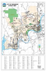
Branson Street Map
Street map of Branson, Missouri. With street index.
339 miles away
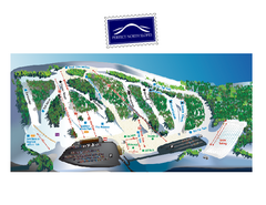
Perfect North Slopes Ski Trail Map
Trail map from Perfect North Slopes, which provides downhill, nordic, and terrain park skiing. It...
339 miles away
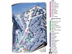
Sugar Mountain Resort Ski Trail Map
Trail map from Sugar Mountain Resort.
340 miles away
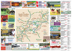
Avery County Attractions Map
Avery County Attractions Map
341 miles away

Avery County Restaurants Map
Avery County Tourist Map
341 miles away
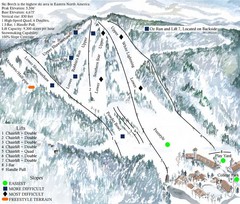
Beech Mountain Ski Resort Ski Trail Map
Trail map from Beech Mountain Ski Resort.
341 miles away
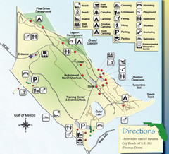
St. Andrews State Park Map
Overview map of St. Andrews State Park, #2 beach in America by TripAdvisor.com, 2008
341 miles away

Walnut Point State Park, Illinois Site Map
341 miles away
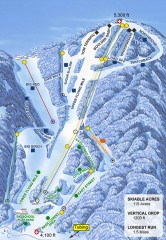
Sugar Mountain Ski Trail Map
Official ski trail map of Sugar Mountain ski area
341 miles away
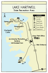
Lake Hartwell State Park Map
Clear state park map.
342 miles away
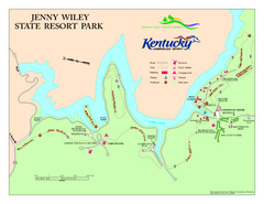
Jenny Wiley State Resort Park Map
Map of trails and facilities of Jenny Wiley State Resort Park.
342 miles away
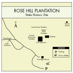
Rose Hill Plantation Map
Clear and simple state park map.
342 miles away
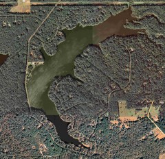
Lake Tallavana Map
Lake Tallavana aerial Map of the lake and surrounding areas.
344 miles away

Lake Tallavana Parcel Map
Lake Tallavana Parcel Map
344 miles away
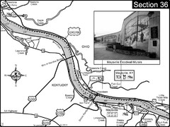
Ohio River at Maysville, Kentucky Map
This is a page from the Ohio River Guidebook. The map shows important information for boaters and...
345 miles away
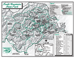
South Mountains State Park map
Detailed recrational map for South Mountain State Park in North Carolina
346 miles away

Stone House Trail Map
346 miles away
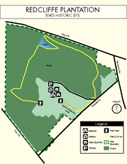
Redcliffe Plantation State Park Map
Clear map of this wonderful state park with a beautiful natural setting.
346 miles away
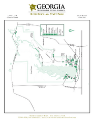
Reed Bingham State Park Map
Map of park with detail of trails and recreation zones
346 miles away

Cincinnati, Ohio City Map
346 miles away
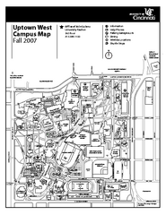
University of Cincinnati - Main Campus Map
University of Cincinnati - Main Campus Campus Map. All areas included.
346 miles away
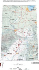
Earthquakes in the Central US Map
Map of central U.S. earthquakes from 1699 to 2002
346 miles away

