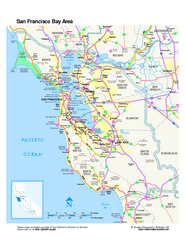
San Francisco Bay Area Map
Overview road map of the San Francisco Bay Area, California
265 miles away
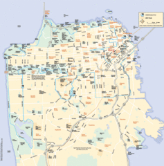
San Francisco Neighborhood Map
Neighborhood map of San Francisco, CA. Shows 49 mile scenic drive.
265 miles away

Double Decker Tour Bus Map
265 miles away
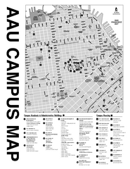
Academy of Art University San Francisco, CA Map
265 miles away
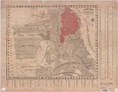
1907 San Francisco Earthquake Map
Map of areas destroyed by fire after 1906 earthquake
265 miles away

Granite Chief Wilderness Map
Trail map of Granite Chief Wilderness in Lake Tahoe region. Shows trails (inlcuding Pacific Crest...
265 miles away
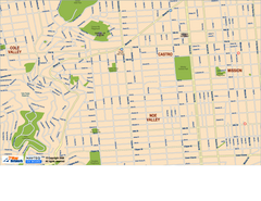
Downtown San Francisco: Castro and Noe Valley Map
Tourist map of the Castro and Noe Valley area in downtown San Francisco, California. Shows Twin...
265 miles away
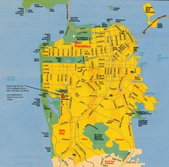
San Francisco City Map
City map of San Francisco with Lowell High School highlighted
265 miles away
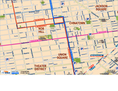
Downtown San Francisco: Union Square, Chinatown...
Tourist map of Union Square, Chinatown and Nob Hill in Downtown San Francisco, California. Public...
265 miles away
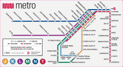
San Francisco Muni Metro map
Official SFMTA San Francisco MUNI Metro map. Shows overlapping BART stations and the Cal Train...
265 miles away
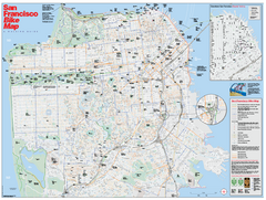
San Francisco Bike Map
Map showing bike paths, bike lanes, bike shops, public transportation, and grades of hills in San...
265 miles away

Farwell’s Map of Chinatown in San Francisco...
This map of vice in San Francisco's Chinatown in 1885. A fascinating historical document, as...
265 miles away
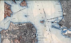
San Francisco Map 1915
265 miles away
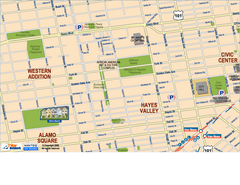
Hayes Valley, Fillmore, Western Addition, Alamo...
Tourist map of Hayes Valley, Fillmore, Western Addition, and Alamo Square in San Francisco.
265 miles away
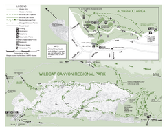
Wildcat Canyon Regional Park Map
265 miles away
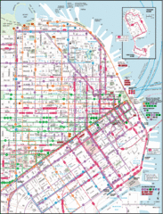
San Francisco Map
Highly detailed map of San Francisco roads and transportation.
265 miles away
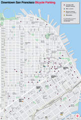
San Francisco Bike Parking Map
Multiple bike-parking points in San Francisco.
265 miles away
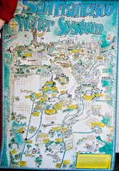
San Francisco Water System Cartoon Map
Cartoon map of the San Francisco Water System. From photo of poster from San Francisco Public...
265 miles away
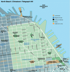
North Beach, Chinatown, Telegraph Hill map
Tourist map of North Beach, Chinatown, and Telegraph Hill in San Francisco
265 miles away
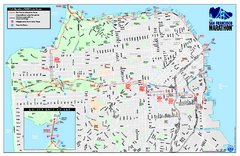
San Francisco 2009 Marathon Map
Guide to the 2009 San Francisco Marathon and Half Marathon
265 miles away
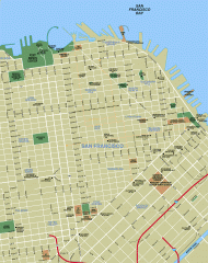
Downtown San Francisco tourist map
Tourist map of Downtown San Francisco spanning several neighborhoods, showing points of interest.
265 miles away
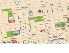
Downtown San Francisco: Hayes Valley, Western...
Tourist map of Hayes Valley, Western Addition, and Civic Center area of downtown San Francisco...
265 miles away
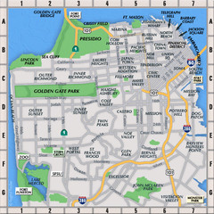
San Francisco Neighborhoods Map
265 miles away

Bay to Breakers race course Map
Bay to Breakers course. Held annually on the third Sunday in May. "ING Bay to Breakers...
266 miles away
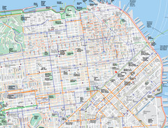
San Francisco Map
Road and Bike routes in San Francisco
266 miles away
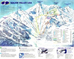
Squaw Valley Ski Trail Map
Scan of ski trail map of Squaw Valley ski area from the 2000-2001 season.
266 miles away
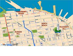
Downtown San Francisco: Fisherman's Wharf...
Tourist map of Fisherman's Wharf, North Beach, and Telegraph Hill area in downtown San...
266 miles away
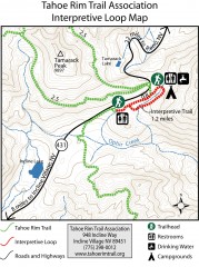
Tahoe Rim Trail: Interpretive Loop, Lake Tahoe...
Trail map of the Tahoe Rim Trail's Interpretive Loop Trail. Shows both trails, camping...
266 miles away
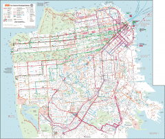
San Francisco Muni system map
Transit Muni system map shows all bus, subway metro, cable car, and streetcar routes.
266 miles away
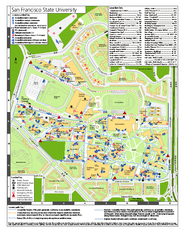
San Francisco State University Map
Campus map of San Francisco State University. All areas shown.
266 miles away
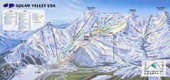
Squaw Valley USA Ski Trail Map
Trail map from Squaw Valley USA, which provides downhill, night, nordic, and terrain park skiing...
266 miles away
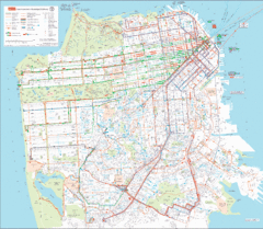
San Francisco Public Transportation map
Transit Muni system map shows all bus, subway metro, cable car, and streetcar routes.
266 miles away
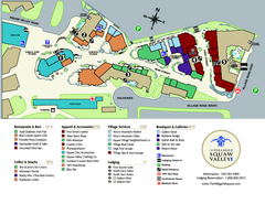
Squaw Valley Base Village Map
Village map of base of Squaw Valley Ski Resort, Lake Tahoe, California. Shows all restaurants...
266 miles away
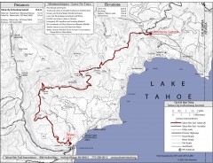
Tahoe Rim Trail: Tahoe City to Brockway Summit Map
Topographic hiking map of the Tahoe City-Brockway Summit leg of the Tahoe Rim Trail. Shows trail...
266 miles away
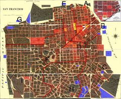
San Francisco Crime Map
A visual representation of crime in San Francisco. This high-level city map of San Francisco shows...
266 miles away
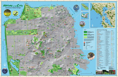
San Francisco Natural Heritage Map
Shows San Francisco's natural habitats and biodiversity is filled with fun facts, restoration...
266 miles away
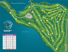
Harding Park Golf Course Map
Course map of Harding Park Golf Course in San Francisco, CA. 18 hole, par 70 course
266 miles away
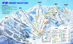
Squaw Valley USA Trail Map
Trail map of Squaw Valley ski area in Lake Tahoe, California
266 miles away
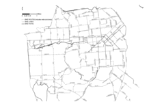
San Francisco Bike Map
Streets in San Francisco
266 miles away
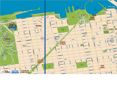
Downtown San Francisco: Fort Mason, the Marina...
Tourist map of Fort Mason, the Marina, and Pacific Heights area in downtown San Francisco...
267 miles away

