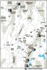
Cross-country Skiing, Elko County, Nevada Map
Map of cross-country skiing opportunities in Elko County, Nevada. Shows skiing locations, roads...
306 miles away
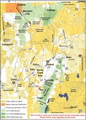
Land Use Map of Elko County, Nevada
Land use map of Elko County, Nevada. Shows lands classified as public or private, and owners of...
306 miles away
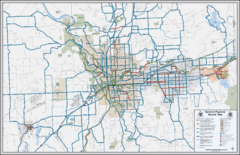
Spokane, Washington Bike Map
306 miles away
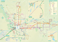
Spokane Guide Map
Roads and areas in and around Spokane, Washington
306 miles away
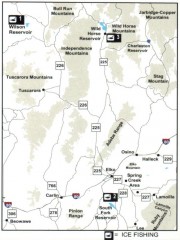
Icefishing Map, Elko County, Nevada
Map of ice fishing locations in Elko County, NV. Shows reservoirs, roads and towns.
307 miles away
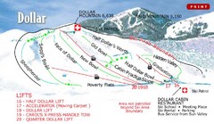
Sun Valley—Bald Mountain Ski Trail Map
Trail map from Sun Valley—Bald Mountain, which provides downhill, nordic, and terrain park skiing...
308 miles away
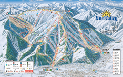
Sun Valley Ski Trail Map 2008
Ski trail map of Sun Valley ski area
308 miles away
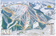
Sun Valley Ski Area Trail Map
Official ski trail map of Bald Mountain, the main mountain of Sun Valley ski area in Sun Valley...
308 miles away

Tahoe Donner Ski Trail Map
Trail map from Tahoe Donner, which provides downhill, night, and nordic skiing. It has 3 lifts...
308 miles away
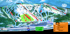
Boreal Mountain Resort Ski Trail Map
Trail map from Boreal Mountain Resort, which provides downhill, night, and terrain park skiing. It...
309 miles away
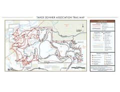
Tahoe Donner Ski Trail Map
Official ski trail map of Tahoe Donner Association. Shows both downhill and cross-country ski...
309 miles away
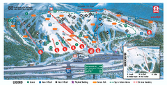
Boreal Ski Trail Map
Official ski trail map of Boreal ski area
309 miles away
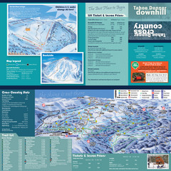
Tahoe Donner Cross Country Ski Trail Map
Ski trail map of Tahoe Donner Association. Shows both downhill and cross-country ski trails...
309 miles away
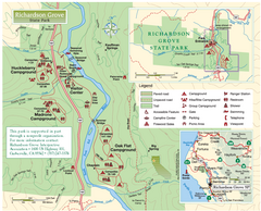
Richardson Grove State Park Map
Park map of Richardson Grove State Park, California. Shows trails, campgrounds, and other...
310 miles away
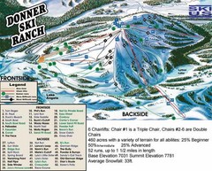
Donner Ski Ranch Ski Trail Map
Trail map from Donner Ski Ranch, which provides downhill and terrain park skiing. It has 6 lifts...
310 miles away
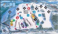
Soda Springs Ski Trail Map
Trail map from Soda Springs, which provides downhill and terrain park skiing. It has 2 lifts...
310 miles away
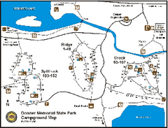
Donner Memorial State Park Campground Map
Map of park with detail of trails and recreation zones
311 miles away
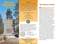
Donner Memorial State Park Map
Map of park with detail of trails and recreation zones
311 miles away

Whidbey Island tourist map
Tourist map of Whidbey Island and Coupeville, Washington. Shows all businesses.
311 miles away
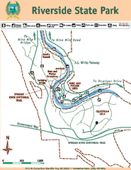
Riverside State Park Map
Map of park with detail of trails and recreation zones
311 miles away
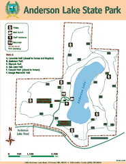
Anderson Lake State Park Map
Map of park and trails
311 miles away
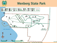
Wenberg State Park Map
Map of park with detail of trails and recreation zones
311 miles away
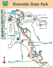
Riverside State Park Map
Map of park with detail of trails and recreation zones
311 miles away
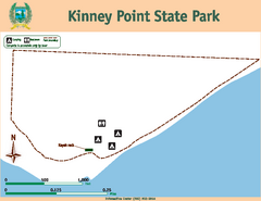
Kinney Point State Park Map
Map of island with detail of trails and recreation zones
311 miles away
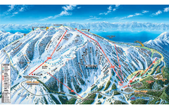
Mt. Rose Ski Tahoe Ski Trail Map
Trail map from Mt. Rose Ski Tahoe.
311 miles away
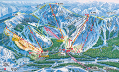
Sugar Bowl Resort Ski Trail Map
Trail map from Sugar Bowl Resort, which provides downhill and terrain park skiing. It has 12 lifts...
312 miles away
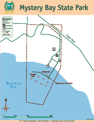
Mystery Bay State Park Map
Map of park with detail of trails and recreation zones
312 miles away
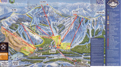
Sugar Bowl Ski Trail Map
Ski trail map of Sugar Bowl ski area from the 2008-09 season. Scanned.
312 miles away
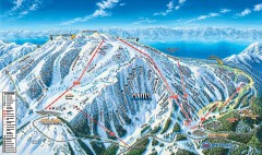
Mt. Rose Ski Trail Map
Official ski trail map of Mt. Rose ski area
312 miles away
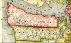
Clallam and Jefferson Counties Washington, 1909...
313 miles away
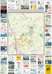
Arlington tourist map
Tourist map of Arlington, Washington. Shows all businesses.
313 miles away
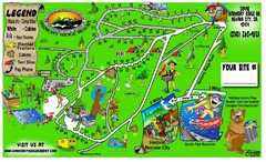
Harmony Ridge Resort Map
313 miles away
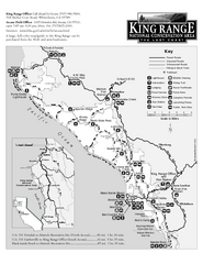
King Range National Conservation Area Trail Map
Trail map of the King Range National Conservation Area, home of the Lost Coast, California. Shows...
313 miles away

Arlington and Smokey Point tourist map
Tourist map of Arlington and Smokey Point, Washington. Shows all businesses.
314 miles away
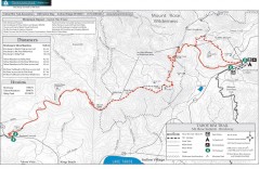
Tahoe Rim Trail: Brockway Summit to Tahoe Meadows...
Trail map of the Brockway Summit-Tahoe Meadows leg of the Tahoe Rim Trail. Bike trails, hiking...
314 miles away
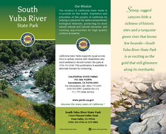
South Yuba River State Park Map
Map of park with detail of trails and recreation zones
314 miles away
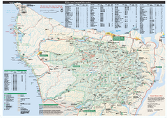
Olympic National Park wilderness campsite map
Official wilderness campsite map of Olympic National Park. Shows roads, trails, visitor...
314 miles away
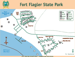
Fort Flagler State Park Map
Map of park with detail of trails and recreation zones
314 miles away
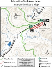
Tahoe Rim Trail: Interpretive Loop, Lake Tahoe...
Trail map of the Tahoe Rim Trail's Interpretive Loop Trail. Shows both trails, camping...
315 miles away
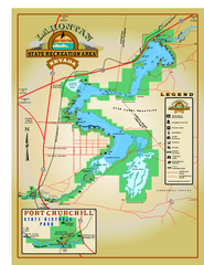
Lahontan State Recreation Area Map
Overview map of Lahontan State Recreation Area. Shows Lahontan Reservoir formed by Lahontan Dam...
315 miles away

