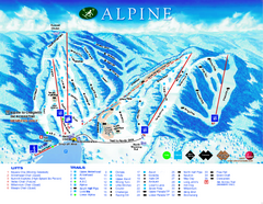
Alpine Ski Club Ski Trail Map
Trail map from Alpine Ski Club, which provides downhill skiing. This ski area has its own website.
334 miles away
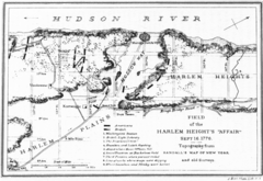
Harlem Hieghts Affair Map
Topography of the field during the battle on Sept 16 1776
334 miles away
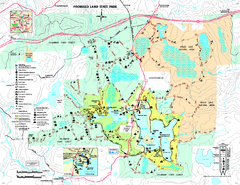
Promised Land State Park map
Detailed recreation map for Promised Land State Park in Pennsylvania
334 miles away
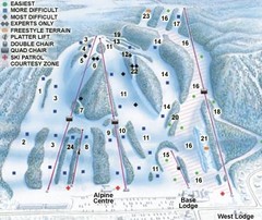
Georgian Peaks Club Ski Trail Map
Trail map from Georgian Peaks Club, which provides downhill and nordic skiing. This ski area has...
335 miles away
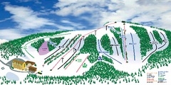
Hockley Valley Resort Ski Trail Map
Trail map from Hockley Valley Resort, which provides downhill skiing. This ski area has its own...
336 miles away
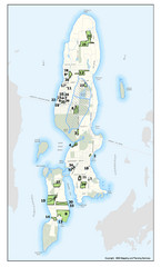
Conanicut Island Land Trust Map
Shows 430 acres of property on Conanicut Island, RI stewarded by the Conanicut Island Land Trust
336 miles away
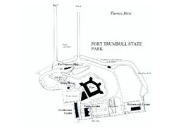
Fort Trumbull State Park map
Map of Fort Trumbull State Park in Connecticut.
336 miles away

Hammonasset Beach State Park map
Trail map for Hammonasset Beach State Park in Connecticut.
337 miles away

Hammonasset Beach State Park campground map
Campground map of Hammonasset State Park in Connecticut.
337 miles away
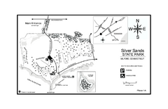
Silver Sands State Park map
Trail and campground map of Silver Sands State Park in Connecticut.
337 miles away
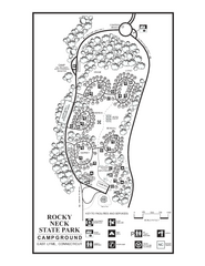
Rocky Neck State Park campground map
Campground map of Rocky Neck State Park in Connecticut.
337 miles away
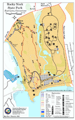
Rocky Neck State Park trail map
Trail map of Rocky Neck State Park in Connecticut.
337 miles away
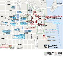
New Bedford Whaling National Historical Park...
Official NPS map of New Bedford Whaling National Historical Park in Massachusetts. Map shows all...
337 miles away
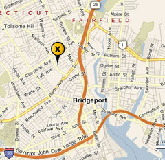
Bridgeport, Connecticut City Map
337 miles away
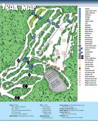
Sno Mountain Ski Trail Map
Official ski trail map of Sno Mountain ski area from the 2007-2008 season.
337 miles away
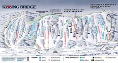
Kissing Bridge Ski Trail Map
Trail map from Kissing Bridge.
337 miles away
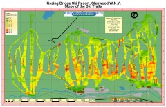
Kissing Bridge Ski Slope Map
Map of Kissing Bridge ski area; shows steepness of slopes with color-coding.
337 miles away

Hills Creek State Park map
Detailed map of Hills Creek State Park in Pennsylvania
337 miles away

Hidden Valley Ski Trail Map
Trail map from Hidden Valley.
338 miles away

Mountain Creek South Ski Trail Map
Trail map from Mountain Creek.
338 miles away
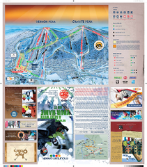
Mountain Creek North Ski Trail Map
Trail map from Mountain Creek.
338 miles away
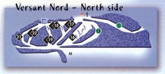
Val D’Irene North Side Ski Trail Map
Trail map from Val D’Irene, which provides downhill and nordic skiing. This ski area has its own...
338 miles away
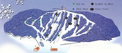
Val D’Irene South Side Ski Trail Map
Trail map from Val D’Irene, which provides downhill and nordic skiing. This ski area has its own...
338 miles away
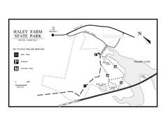
Haley Farm State Park map
Trail map of Haley Farm State Park in Connecticut.
338 miles away
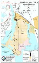
Bluff Point State Park map
Trail map for Bluff Point State Park and Coastal Reserve.
338 miles away
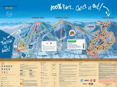
Mountain Creek Ski Trail Map
Official ski trail map of Mountain Creek ski area from the 2007-2008 season. (formerly Vernon...
338 miles away
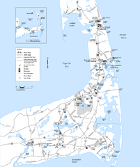
Cape Cod Rail Trail Map
Cape Cod Rail Trail map. The Cape Cod Rail Trail follows a former railroad right-of-way for 22...
338 miles away
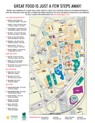
Arena at Harbor Yard Restaurants Map
List of many delicious restaurants and eateries.
338 miles away
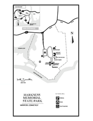
Harkness Memorial State Park map
Trail map of Harkness Memorial State Park in Connecticut.
338 miles away
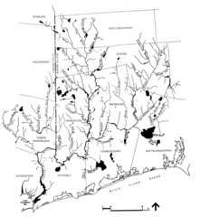
Rhode Island Coastal Watershed Map
Paddling Guide of Pawcatuck River Watershed
339 miles away
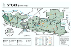
Stokes State Forest map
Trail map of Stokes State Park in New Jersey.
339 miles away
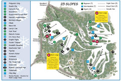
Caledon Ski Club Ski Trail Map
Trail map from Caledon Ski Club, which provides downhill skiing. This ski area has its own website.
340 miles away
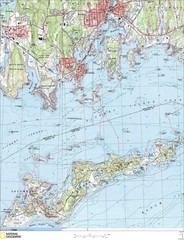
Fishers Island Map
In Long Island Sound
340 miles away
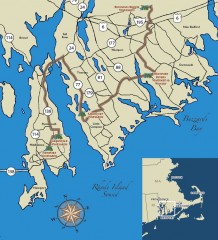
Southeastern New England Wine Trail Map
Map of the Southeastern New England Wine Trail, showing all vineyards and wineries that are members...
340 miles away
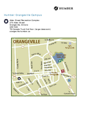
Humber College Orangeville Campus Map
Humber College Orangeville Campus Map. Shows all areas.
340 miles away
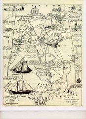
Wellfleet 1930s Tourist Map
A tourist map from the 1930s of Wellfeet, Massachusetts in Cape Cod. Courtesy of Cynthia Blakeley
341 miles away
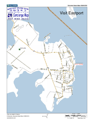
Eastport, Maine, USA Map
Maine Coast Welcome Center's local Map of Eastport, Me with recommended business locations.
341 miles away
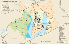
Frances Slocum State Park map
Detailed map of Frances Slocum State Park in Pennsylvania.
341 miles away
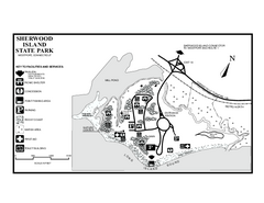
Sherwood Island State Park map
Trail and campground map of Sherwood Island State Park in Connecticut.
342 miles away
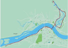
Fredericton Marathon Course Map 2007
Course map of the Fredericton, New Brunswick marathon May 2007
343 miles away

