Mission Ridge Winter Park Ski Trail Map
Trail map from Mission Ridge Winter Park, which provides downhill skiing. This ski area has its own...
365 miles away
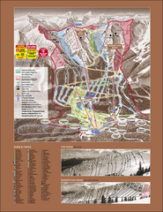
Kicking Horse Ski Trail Map 2007-08
Official ski trail map of Kicking Horse ski area from the 2007-2008 season.
366 miles away
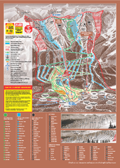
Kicking Horse Ski Trail Map 2009-10
Ski trail map of Kicking Horse ski area for the 2009-2010 season. Features 3 alpine bowls and 70...
366 miles away
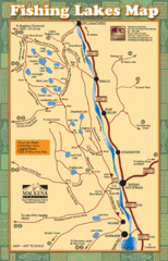
Radium Hot Springs Fishing Map
Beautiful map of the many fishing spots at this amazing site.
367 miles away
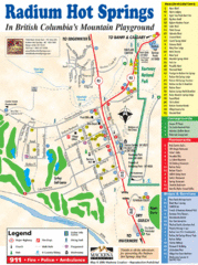
Radium Hot Springs Map
An easy to read map of this amazing hot springs area.
367 miles away
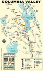
Columbia Valley Map
Easy to follow map and legend of this wilderness area.
368 miles away
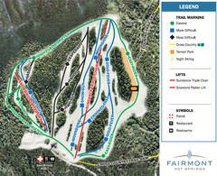
Fairmont Hot Springs Resort Ski Trail Map
Trail map from Fairmont Hot Springs Resort.
375 miles away

Panorama Trail Map
Ski trail map
379 miles away
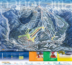
Panorama Mountain Village Ski Trail Map
Trail map from Panorama Mountain Village.
380 miles away
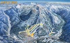
Panorama Ski Trail Map
Official ski trail map of Panorama ski area from the 2006-2007 season.
380 miles away
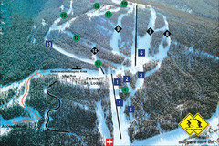
Pass Powderkeg Ski Trail Map
Trail map from Pass Powderkeg, which provides downhill skiing. This ski area has its own website.
384 miles away
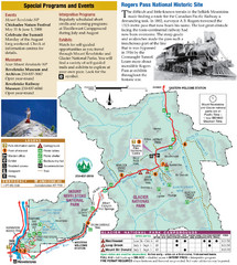
Glacier National Park and Revelstoke National...
Official park map of Glacier National Park and Revelstoke National Park in British Columbia, Canada.
391 miles away
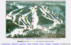
Whispering Pines Ski Trail Map
Trail map from Whispering Pines, which provides downhill and nordic skiing. This ski area has its...
396 miles away
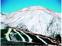
Castle Mountain Resort Ski Trail Map
Trail map from Castle Mountain Resort, which provides downhill skiing. This ski area has its own...
401 miles away
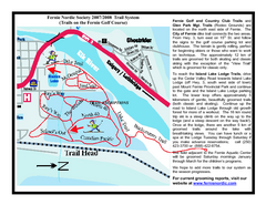
Fernie Golf Course Ski Trail Map
Trail map from Fernie Golf Course, which provides nordic skiing. This ski area has its own website.
402 miles away
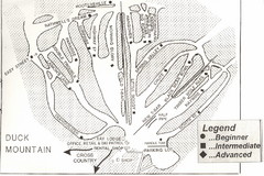
Duck Mountain Ski Trail Map
Trail map from Duck Mountain, which provides downhill and nordic skiing. This ski area has its own...
402 miles away
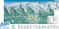
Fernie Mountain Trail Map
403 miles away
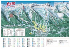
Fernie Mountain Trail Map
403 miles away
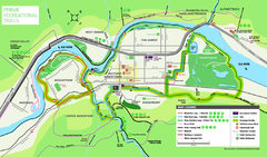
Fernie Town Trails Map
Trail map of recreational trails in and around town of Fernie, BC
403 miles away
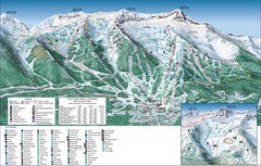
Fernie Alpine Trail Map
Ski trail map
403 miles away
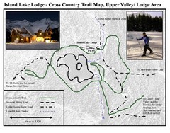
Island Lake Lodge Ski Trail Map
Trail map from Island Lake Lodge, which provides nordic skiing. This ski area has its own website.
405 miles away
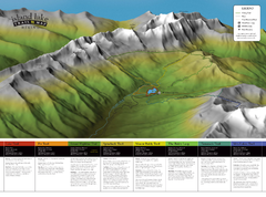
Island Lake Hiking Map
Hiking trail map of Island Lake area near Fernie, BC
406 miles away
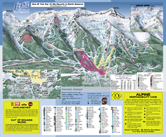
Fernie Alpine Resort Ski Trail Map
Trail map from Fernie Alpine Resort, which provides downhill and nordic skiing. This ski area has...
406 miles away
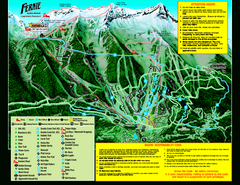
Fernie Alpine Resort 2007 Fernie Summer Map
Trail map from Fernie Alpine Resort, which provides downhill and nordic skiing. This ski area has...
406 miles away
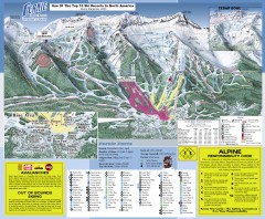
Fernie Ski Trail Map
Official ski trail map of Fernie ski area from the 2007-2008 season.
407 miles away

Kootenay Rockies Map
The Kootenay Rockies Range in British Columbia, Canada
414 miles away
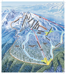
Revelstoke Ski Trail Map - North Bowl
Ski trail map of the North Bowl of Revelstoke ski area in Revelstoke, BC. From the 2008-2009...
415 miles away
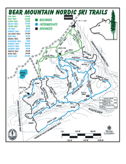
Bear Mountain Nordic Ski Trail Map
Trail map from Bear Mountain.
415 miles away
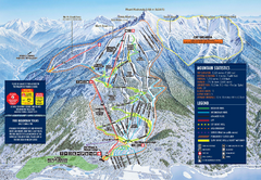
Revelstoke Ski Trail Map 2009-2010
Official ski trail map of Revelstoke Mountain Resort from the 2009-2010 season.
415 miles away
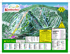
Kimberley Alpine Resort Ski Trail Map
Trail map from Kimberley Alpine Resort.
416 miles away
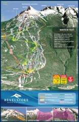
Revelstoke Ski Trail Map
Official ski trail map of Revelstoke ski area from the inaugural 2007-2008 season.
416 miles away
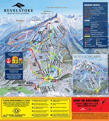
Revelstoke Ski Trail Map 2010-11
Ski trail map of Revelstoke Mountain Resort for the 2010-2011 season. Inset shows North Bowl area.
416 miles away
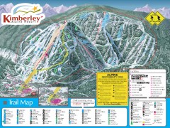
Kimberley Ski Trail Map
Official ski trail map of Kimberley ski area from the 2007-2008 season.
416 miles away
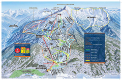
Revelstoke Ski Trail Map - Front side
Ski trail map of front side of Revelstoke ski area in Revelstoke, Canada from the 2008-2009 season.
416 miles away

Revelstoke City Map
Overview map of Revelstoke, BC. Shows Points of Interest and activity icons
417 miles away
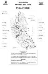
Mt. Macpherson Mountain Bike Trail Map
Mountain bike trail maps of Mt. Macpherson area and Mt. Mackenzie area right out of the town of...
419 miles away
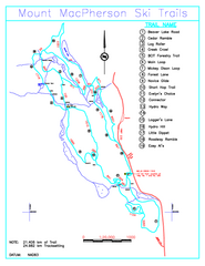
Revelstoke Nordic—Mount MacPherson Nordic Ski...
Trail map from Revelstoke Nordic—Mount MacPherson, which provides nordic skiing. This ski area...
420 miles away
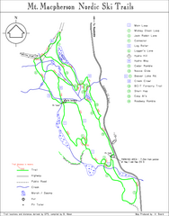
Mt Macpherson Nordic Ski Trail map
Nordic ski trail map of Mt Macpherson area near Revelstoke, BC. Shows trail names and distances in...
421 miles away

Glacier National Park by carvedmaps.com Map
Wooden carved map of Glacier National Park by carvedmaps.com Anywhere in the United States maps...
426 miles away

