
Cape Cod Hospital Map
Campus map of Cape Cod Hospital
471 miles away

Cape Cod Hospital Map
Map of external vicinity of Cape Cod Hospital
471 miles away
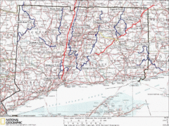
Connecticut Long Distance Trails Map
A map of long distance trails throughout Connecticut. Go to the website below for detailed trail...
471 miles away
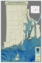
Rhode Island Shaded Bathymetry Map
Bathymetric map of Rhode Island with Narrangansett Bay and Rhode Island Sound. Graduated...
472 miles away

Topsmead State Forest map
Trail map for Topsmead State Forest in Connecticut.
472 miles away
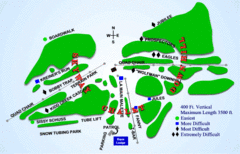
Kamiskotia Ski Resort Ski Trail Map
Trail map from Kamiskotia Ski Resort, which provides downhill skiing. This ski area has its own...
473 miles away
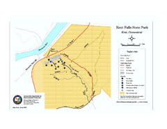
Kent Falls State Park trail map
Trail map of Kent Falls State Park in Connecticut.
473 miles away
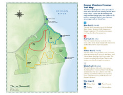
Esopus Meadows Preserve Trail Map
Trail map of Esopus Meadows Preserve park on the Hudson River.
473 miles away
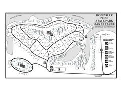
Hopeville Pond campground map
Campground map of Hopeville Pond State Park in Connecticut.
474 miles away
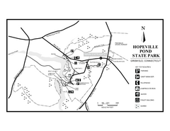
Hopeville Pond State Park trail map
Trail map for Hopevill Pond State Park in Connecticut
474 miles away
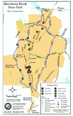
Macedonia Brook State Park trail map
Trail map of Macedonia Brook State Park in Connecticut.
474 miles away
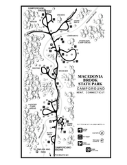
Macedonia Brook State Park campground map
Campground map for Macedonia Brook State Park in Connecticut.
474 miles away
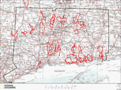
Connecticut Road Cycling Routes Map
A map of road cycling routes throughout Connecticut. Follow the link below for detailed route maps...
474 miles away
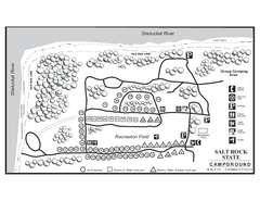
Salt Rock State Park campground map
Campground Map of Salt Rock State Campground in Connecticut.
474 miles away
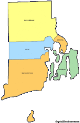
Rhode Island Counties Map
474 miles away
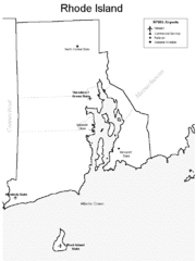
Rhode Island Airports Map
474 miles away
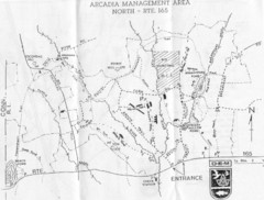
Arcadia Management Area State Map
Trail map for Arcadia Management Area in Rhode Island
474 miles away
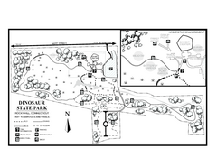
Dinosaur State Park map
Trail map of Dinosaur State Park in Connecticut.
474 miles away
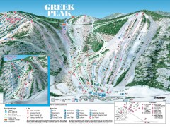
Greek Peak Ski Trail Map
Official ski trail map of Greek Peak ski area from the 2006-2007 season.
474 miles away

Greek Peak Ski Resort Ski Trail Map
Trail map from Greek Peak Ski Resort.
475 miles away
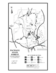
Pachaug State Forest map
Trail map of Pachaug State Forest in Connecticut.
475 miles away
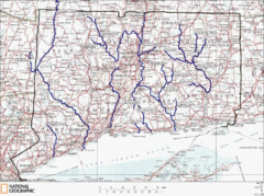
Connecticut Rivers and Coastal Paddling Map
This is a map of paddling areas for rivers and coastal kayaking. Follow the link below for...
475 miles away
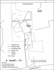
Parker Farm Trail Map
476 miles away
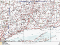
Connecticut Rock Climbing Locations Map
A map of most of the important rock climbing and bouldering areas in Connecticut. Click the link...
476 miles away
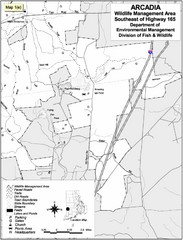
Arcadia Wildlife Management Area Map - Southeast
Reference map shows portion of Arcadia Wildlife Management Area, Rhode Island southeast of Highway...
476 miles away

St. John Fisher College Map
Campus map
476 miles away
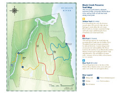
Black Creek Trail Preserve Map
Trail map of Black Creek Preserve on the Hudson River in New York. Shows Yellow Trail, Red Trail...
476 miles away
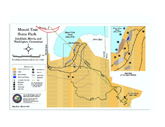
Mount Tom State Park trail map
Trail map of Mt. Tom State Park in Connecticut.
477 miles away

Downtown Rochester, New York Map
Tourist map of downtown Rochester, New York. Various areas of interest, parking, and streets are...
477 miles away
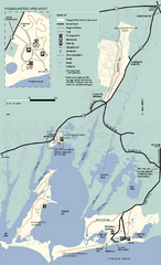
Waquoit Bay National Estuarine Research Preserve...
Trail map of Waquoit Bay National Estuarine Research Preserve in Massachusetts.
477 miles away
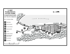
Lake Waramaug State Park campground map
Campground map of Lake Waramaug State Park.
477 miles away
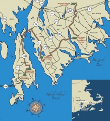
Southeastern New England Wine Trail Map
Map of the Southeastern New England Wine Trail, showing all vineyards and wineries that are members...
477 miles away

Rochester, New York City Map
478 miles away
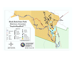
Black Rock State Park trail map
Trail map of Black Rock State Park in Connecticut.
478 miles away
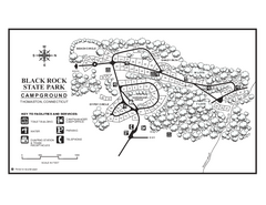
Black Rock Campground map
Map of the Campgrounds in Black Rock State Park.
478 miles away
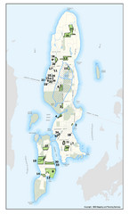
Conanicut Island Land Trust Map
Shows 430 acres of property on Conanicut Island, RI stewarded by the Conanicut Island Land Trust
478 miles away
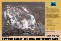
Yawgoo Valley Ski Trail map
Map of Yawgoo Valley Ski area in Exeter, Rhode Island. It is the only skiing resort in Rhode...
479 miles away
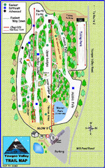
Yawgoo Valley Ski Area Ski Trail Map
Trail map from Yawgoo Valley Ski Area.
479 miles away
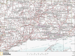
Connecticut Canoeing and Kayaking Lakes Map
A map of the lakes and ponds that are open for canoeing and kayaking in Connecticut. For detailed...
479 miles away
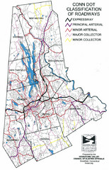
Connecticut Roadway Classification Map
479 miles away

