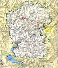
Rocky Mountain National Park Map
Rocky Mountain National Park Map and surrounding National Forests of Arapaho and Roosevelt.
274 miles away
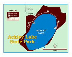
Ackley Lake State Park Map
Simple map of the State Park.
275 miles away
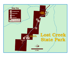
Lost Creek State Park Map
These spectacular gray limestone cliffs and pink and white granite formations rise 1,200 feet above...
275 miles away
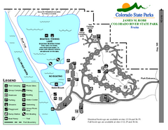
Fruita Area State Park Map
Map of fruita section of the James M Robb Colorado River State Park
276 miles away
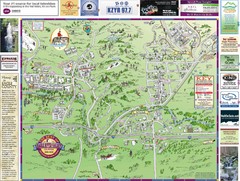
Resort Maps of Eagle River Valley Map
Resort Maps of Eagle River Valley is the most popular and widely distributed map of Minturn, Red...
276 miles away
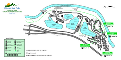
Island Acres State Park Map
Map of island acres section of the James M Robb Colorado River State Park
276 miles away
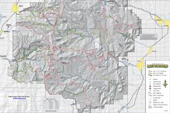
Utha Arapeen OHV Trail System- South Map
Utah Arapeen OHV Trail System map. Located near the towns of Fairview, Ephraim, and Manti, Utah.
276 miles away
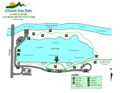
Corn Lake State Park Map
Map of corn lake section of the James M Robb Colorado River State Park
276 miles away
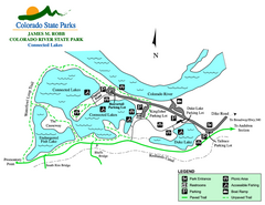
Connected Lakes State Park Map
Map of connected lakes section of the James M Robb Colorado River State Park
277 miles away
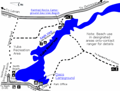
Yuba State Park Map
The sprawling waters of Yuba State Park provide a variety of recreation opportunities for visitors...
277 miles away
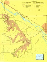
Colorado National Monument Map
Map of Colorado National Monument and surrounding areas.
277 miles away

Oregon Trail Historical Map
277 miles away
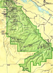
Colorado National Monument Map
277 miles away
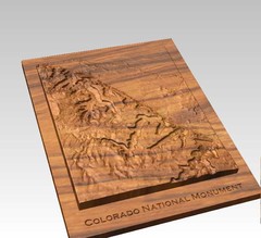
Colorado National Monument carved by CarvedMaps...
Colorado National Monument near Grand Junction, CO. was carved by CarvedMaps.com They can carve...
277 miles away
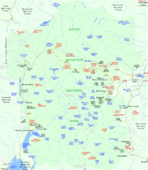
Rocky Mountain National Park Tourist Map
278 miles away
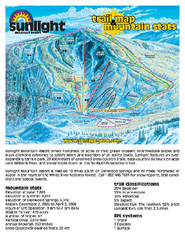
Sunlight Mountain Resort Ski Trail Map
Trail map from Sunlight Mountain Resort, which provides downhill, nordic, and terrain park skiing...
278 miles away
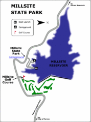
Millsite State Park Map
Camp in the quiet campground, and boat and fish on the blue waters of Millsite Reservoir. Play 18...
279 miles away
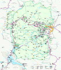
Rocky Mountain National Park Official Map
Rocky Mountain National Park Official Map. Shows all roads, trails, rivers, and mountain summits.
279 miles away
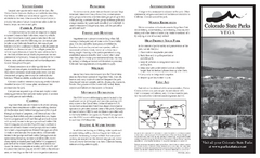
Vega State Park Map
Map of park with detail of recreation zones and campgrounds
279 miles away
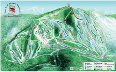
Lost Powder Mountain Ski Trail Map
Trail map from Lost Trail Powder Mountain.
280 miles away
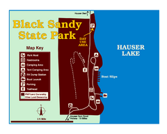
Black Sandy State Park Map
Simple but clear map of State Park.
280 miles away
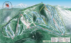
Lost Trail Powder Mountain Ski Trail Map
Official ski trail map of Lost Trail Powder Mountain ski area
280 miles away
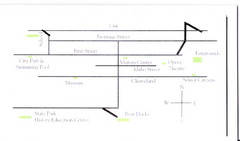
Glenns Ferry City Map
City map of Glenns Ferry, Idaho with information
280 miles away
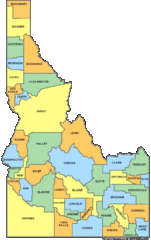
Idaho Counties Map
281 miles away
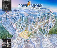
Powderhorn Resort Ski Trail Map
Trail map from Powderhorn Resort, which provides downhill and terrain park skiing. It has 4 lifts...
283 miles away
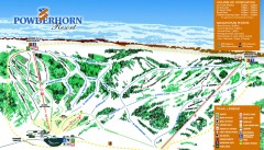
Powderhorn Ski Trail Map
Official ski trail map of Powderhorn Resort ski area from the 2007-2008 season.
284 miles away
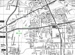
Cheyenne, Wyoming City Map
284 miles away
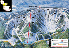
Discovery Basin Ski Area B Ski Trail Map
Trail map from Discovery Basin Ski Area.
284 miles away
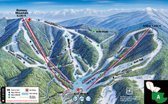
Discovery Basin Ski Area A Ski Trail Map
Trail map from Discovery Basin Ski Area.
284 miles away
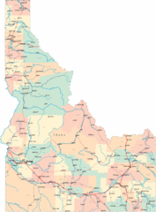
Idaho Road Map
284 miles away
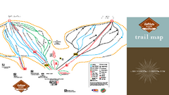
SolVista Basin at Granby Ranch Ski Trail Map
Trail map from SolVista Basin at Granby Ranch, which provides downhill and terrain park skiing. It...
284 miles away
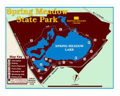
Spring Meadow Lake State Park Map
This urban, day-use-only park minutes from Helena fed by natural springs, is a popular spot for...
285 miles away

Eagle River Valley Resort Maps Map
Resort Maps of Eagle River Valley is the most popular and widely distributed map of Minturn, Red...
285 miles away
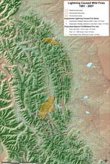
Montana Mountain Range Map
Fires on the Montana mountain range
285 miles away
Beaver Creek Map
Beaver Creek Map, Beaver Creek Shopping Map, Beaver Creek Lodging Map, Activities, Restaurants...
288 miles away
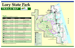
Lory State Park Trail Map
Map of park with detail of hiking trails
288 miles away
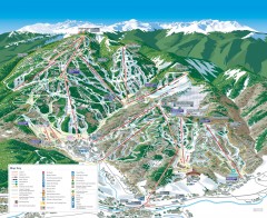
Beaver Creek Ski Trail Map
Official ski trail map of Beaver Creek ski area from the 2007-2008 season. Map also includes...
288 miles away
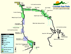
Sylvan Lake State Park Map
Map of park with detail of recreation zones and campgrounds
289 miles away
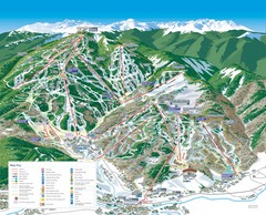
Beaver Creek Resort Ski Trail Map
Trail map from Beaver Creek Resort, which provides downhill and terrain park skiing. It has 16...
289 miles away
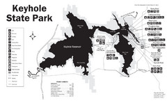
Keyhole State Park Map
Keyhole State Park is located on the western edge of the famed Black Hills, between Sundance and...
289 miles away

