
Burning Map 2005 Map
Artistic representation of Burning Man's Black Rock City.
441 miles away
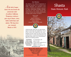
Shasta State Historic Park Map
Map of park with detail of trails and recreation zones
441 miles away
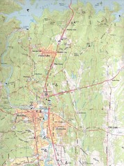
Redding, California City Map
442 miles away
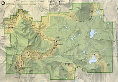
Lassen Volcanic National Park Map
444 miles away
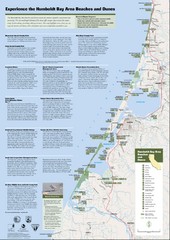
Humboldt Bay Area Beaches and Dunes Map
Humboldt Bay Beaches & Dunes Map & Guide
444 miles away
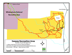
Swasey Recreation Area Map
12 Miles of trails that are great for hiking and biking. Most trails are rugged and unmarked...
444 miles away
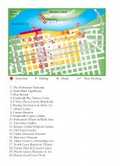
Old Town, Eureka, California Map
Tourist map of the Old Town area of Eureka, California. Shows various attractions including murals...
445 miles away
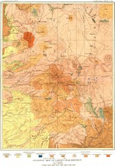
Lassen Peak District Geological Map
Geologic map of the Lassen Peak area in Lassen National Park, California. Shows sedimentary rock...
446 miles away
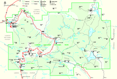
Lassen Volcanic National Park Official Park Map
Official NPS map of Lassen Volcanic National Park in California. Map shows all areas. Lassen...
447 miles away
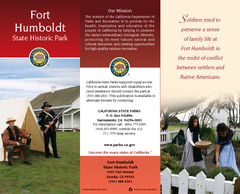
Fort Humboldt State Historic Park Map
Map of park with detail of trails and recreation zones
447 miles away
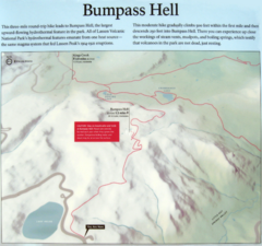
Bumpass Hell Trail Map
Trail map of route to Bumpass Hell, a major area of geo-thermal activity in Lassen National Park...
448 miles away

Helena, Montana City Map
448 miles away
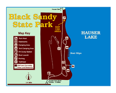
Black Sandy State Park Map
Simple but clear map of State Park.
453 miles away
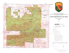
Latour State Forest Map
Countour map of the Latour Demonstration Forest.
454 miles away
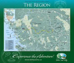
Bella Coola Valley Region Map
Shows large region around Bella Coola, British Columbia, from the northern tip of Vancouver Island...
455 miles away
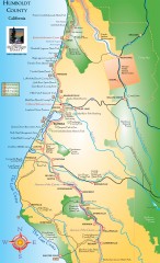
Humboldt County, California Map
Tourist map of Humboldt County, California. Shows parks, wildlife refuges, visitor centers, and...
456 miles away
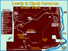
Lewis and Clark Caverns State Park Map
Montana's first and best-known state park showcases one of the most highly decorated limestone...
464 miles away
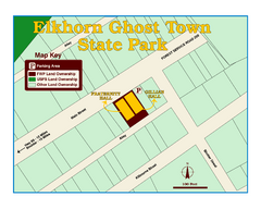
Elkhorn Ghost Town State Park Map
Clearly marked map of old 1880's ghost town with impressive structures.
464 miles away
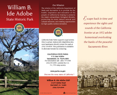
William B. Ide Adobe State Historic Park Map
Map of park with detail of trails and recreation zones
468 miles away
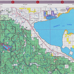
Lassen National Park Map
Forest Visitor Map of the farthest east of the park, shows all camping and recreational areas and...
472 miles away
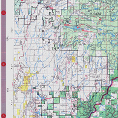
Lassen National Park Map
Visitor Map that shows most of Lassen National Forest with locations of camp grounds and...
473 miles away
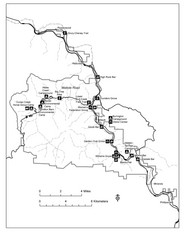
Humboldt Redwoods State Park Map
Park map of Humboldt Redwoods State Park, California. Shows Avenue of the Giants, trailheads and...
474 miles away
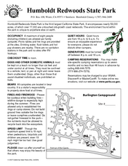
Humboldt Redwoods State Park Campground Map
Map of campground region park with detail of trails and recreation zones
475 miles away
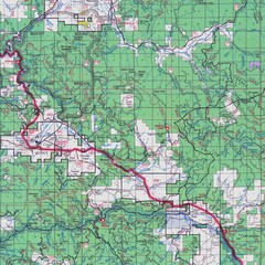
Lassen National Park Map
Forest Visitor Map showing locations of most camping and recreational areas in the eastern part of...
475 miles away
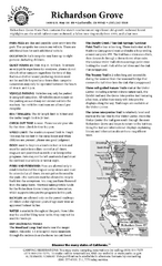
Richardson Grove State Park Campground Map
Map of campground region of park with detail of trails and recreation zones
477 miles away
Richardson Grove State Park Map
Map of park with detail of trails and recreation zones
477 miles away
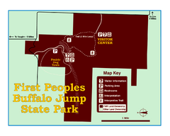
First People's Buffalo Jump State Park Map
A visitor center and interpretive trails tell the story of this prehistoric bison kill site, one of...
479 miles away
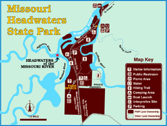
Missouri Headwaters State Park Map
This park encompasses the confluence of the Jefferson, Madison and Gallatin Rivers. The Lewis and...
480 miles away
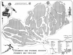
Purden Ski Village Ski Trail Map
Trail map from Purden Ski Village.
482 miles away
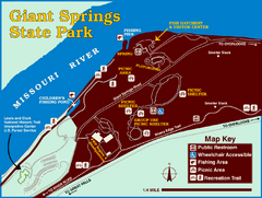
Giant Springs State Park Map
Set aside a whole afternoon to experience this scenic and historic freshwater springs site. First...
483 miles away
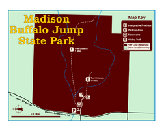
Madison Buffalo Jump State Park Map
You’ll find this day-use-only park seven graveled miles off Interstate 90 at the Logan exit...
484 miles away
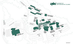
University of Northern British Columbia Campus Map
Campus map of UNBC in Prince George, British Columbia
484 miles away
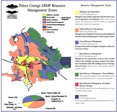
Prince George LRMP Resource Management Zone Map
Prince George Land and Resource Management Plan, color coded by land use.
486 miles away
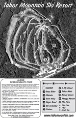
Tabor Mountain 2005–08 Tabor Downhill Map
Trail map from Tabor Mountain.
487 miles away
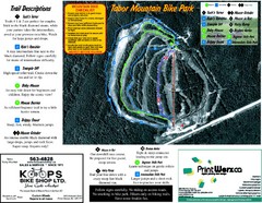
Tabor Mountain 2005–07 Tabor Summer Map
Trail map from Tabor Mountain.
487 miles away
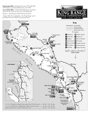
King Range National Conservation Area Trail Map
Trail map of the King Range National Conservation Area, home of the Lost Coast, California. Shows...
488 miles away

Snowmobiling Map, Elko County, Nevada
Map of snowmobiling opportunities in Elko County, Nevada. Snowmobiling areas, roads, and towns are...
490 miles away
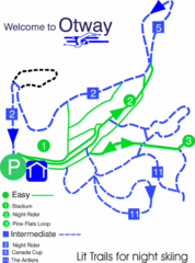
Otway Nordic Centre (Caledonia) Night lit Ski...
Trail map from Otway Nordic Centre (Caledonia), which provides night and nordic skiing. This ski...
490 miles away
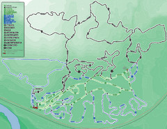
Otway Nordic Centre (Caledonia) Ski Trail Map
Trail map from Otway Nordic Centre (Caledonia), which provides night and nordic skiing. This ski...
490 miles away
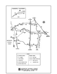
Mendocino National Forest map
Map of the Nome Cult Trail Walk in the Mendocino National Forest.
492 miles away

