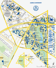
Aarhus University Map
Official map of Aarhus University in Arhus, Denmark
346 miles away
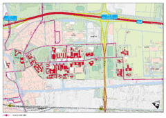
Delft University of Technology Campus Map
346 miles away
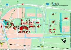
Delft University of Technology Map
347 miles away
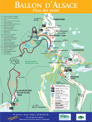
Ballon d’Alsace Ski Trail Map
Trail map from Ballon d’Alsace.
348 miles away
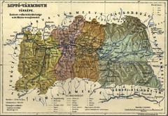
1910 Hungarian Map
Guide to area of Slovakia, previously part of Hungary
348 miles away
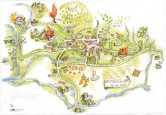
Tramonti di Sopra Tourist Map
Tourist map of town and surrounding area of Tramonti di Sopra, Italy. Drawing shows streets...
349 miles away
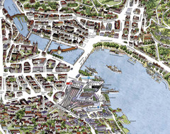
Lucerne Tourist Map
Tourist map of central Lucerne, Switzerland. 3D view showing buildings.
349 miles away
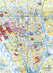
Utrecht, Netherlands Tourist Map
349 miles away
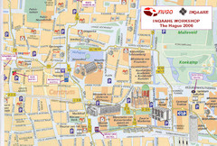
Den Haag, Netherlands Tourist Map
349 miles away
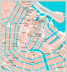
Den Haag, Netherlands Tourist Map
349 miles away
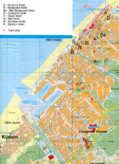
The Hague Hotel Map
Hotel map of The Hague, Netherlands. Shows tram stops. Congress centre highlighted.
349 miles away
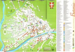
Bormio Tourist Map
Tourist map of town of Bormio, Italy. Legend of all streets and services.
349 miles away
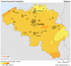
Solar Radiation Map of Belgium
Solar Radiation Map Based on high resolution Solar Radiation Database: SolarGIS. On the Solar Map...
349 miles away
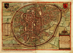
Medieval Brussels Map
349 miles away
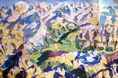
Bormio Panorama Map
Panorama tourist map of Bormio, Italy. Shows Ortler Alps in distance. From photo.
349 miles away
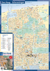
The Hague Tourist Map
Tourist map of The Hague, Netherlands. Shows points of interest.
350 miles away
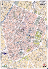
Brussels Street Map
Street map of the center of Brussels, Belgium (Brussel, Bruxelles). Major buildings labeled.
350 miles away
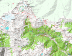
Val di Rabbi Topo Map
Detailed topographic map of Val di Rabbi, Italy on the edge of Stelvio National Park
350 miles away
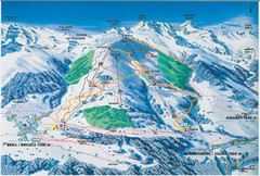
Brigels Ski Trail Map
Trail map from Brigels.
350 miles away
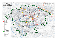
Triglav National Park Map
Triglav National Park is the only Slovenian national park. The park was named after Triglav, the...
350 miles away
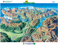
Valdidentro Alta Valtellina Summer Map
Panorama tourist map of the region of Valdidentro Alta Valtellina from Bormio, Italy to Livigno...
350 miles away
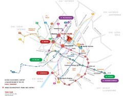
Brussels Transit Map
350 miles away
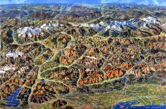
Eastern Alps Italy and Austria Overview Map
Panoramic map of the mountains and towns of northern Italy, the Tyrol, and southern Austria
350 miles away
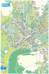
Banska Bystrica Tourist Map
Tourist map of central Banska Bystrica, Slovakia. Shows points of interest. Scanned.
351 miles away
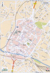
Charleroi Street Map
Street map of Charleroi, Belgium. Major buildings labeled.
352 miles away
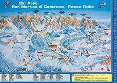
San Martino di Cartozza Ski Trail Map
Ski trail map of San Martino di Cartozza, Italy
352 miles away
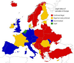
Legal Status of Cannabis in Europe Map
Shows legal status of marijuana in each European country.
352 miles away

St. Moritz Tourist Map
Tourist map of St. Moritz, Switzerland. Shows summer and winter points of interest.
354 miles away
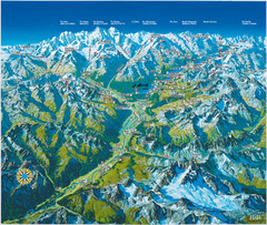
Engadin St. Moritz Region Summer Map
Summer panoramic tourist map of Engadin region of Switzerland. Includes St. Moritz, Piz Bernina...
355 miles away
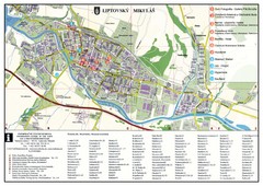
Liptovsky Mikulas Tourist Map
Tourist map of Liptovsky Mikulas, Slovakia
357 miles away
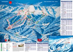
Jasná Ski Trail Map
Trail map from Jasná.
359 miles away
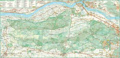
Kampinoski National Park Map
Kampinoski National Park
360 miles away
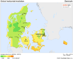
Solar Radiation Map of Denmark
Solar Radiation Map Based on high resolution Solar Radiation Database: SolarGIS. On the Solar Map...
360 miles away
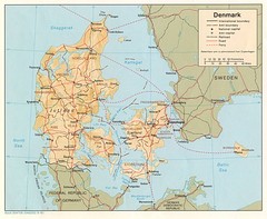
Denmark Map
Map of Denmark showing cities, roads, railways and borders.
360 miles away
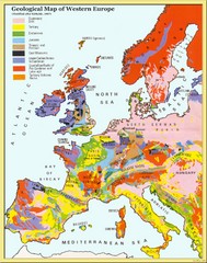
Western Europe Geology Map
Geological map of Western Europe. Modified after Kirkaldy 1967.
360 miles away
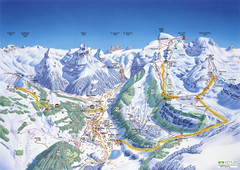
Engelberg Titlis Ski Trail Map
Trail map from Engelberg Titlis.
363 miles away
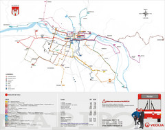
Maribor Bus Map
A map of bus lines in Maribor, Slovenia (Slovenian).
363 miles away
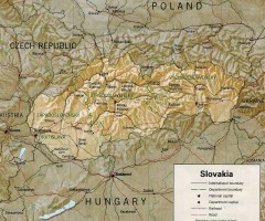
Slovakia country map
Map of Slovakia with surrounding countries. Shows boundaries, major cities, and shaded with...
364 miles away
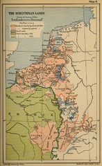
The Burgundian Lands Historical Map
365 miles away
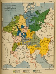
1912 Empire Historical Map
365 miles away

