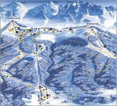
Arnoldstein—Dreiländereck Ski Trail Map
Trail map from Arnoldstein—Dreiländereck, which provides downhill skiing. It has 8 lifts. This...
69 miles away
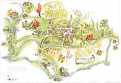
Tramonti di Sopra Tourist Map
Tourist map of town and surrounding area of Tramonti di Sopra, Italy. Drawing shows streets...
69 miles away
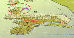
Rab Island Map
Shows beaches on Rab Island, Croatia
73 miles away
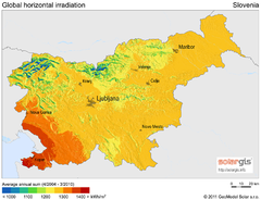
Solar Radiation Map of Slovenia
Solar Radiation Map Based on high resolution Solar Radiation Database: SolarGIS. On the Solar Map...
74 miles away
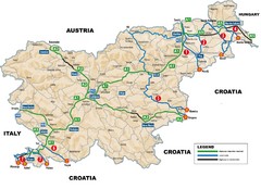
Slovenia Highways Map
74 miles away
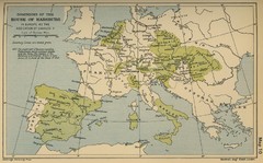
Dominions in the House of Habsburg - 1547...
76 miles away
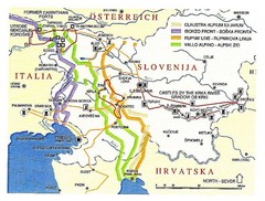
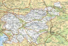
Slovenia Tour Map
78 miles away
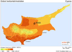
Solar Radiation Map of Cyprus
Solar Radiation Map Based on high resolution Solar Radiation Database: SolarGIS. On the Solar Map...
78 miles away
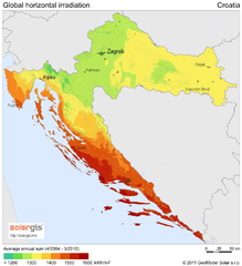
Solar Radiation Map of Croatia
Solar Radiation Map Based on high resolution Solar Radiation Database: SolarGIS. On the Solar Map...
78 miles away
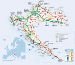
Coratia Tourist Map
Map of Croatia showing roads, international border crossings, parks, airports and ferrys.
78 miles away
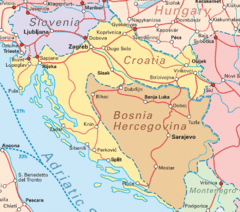
Interrail Routes for Croatia Map
Interrail railway routes for Croatia, Bosnia Hercegovina, Slovenia, and Hungary.
78 miles away
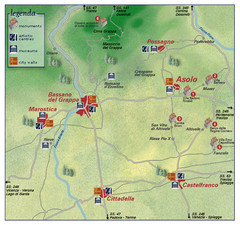
Asolo Italy Area Map
Tourist map of Asolo, Italy surroundings. Shows monuments, art centers, museums, and city walls.
89 miles away
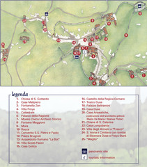
Asolo Town Map
Tourist map of Asolo, Italy. Shows points of interest, panoramic site, and touristic information...
90 miles away
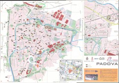
Padova Map
90 miles away
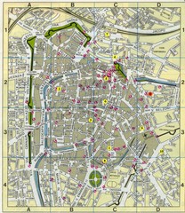
Padova Street Map
Street map of central Padova, Italy. Shows public phones.
90 miles away
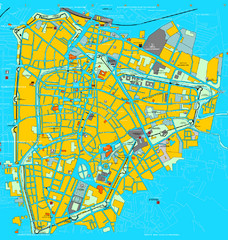
Padova Tourist Map
Tourist map of central Padova (Padua), Italy. Shows major buildings and other tourist information.
91 miles away
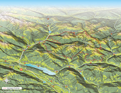
Nockberge National Park Map
Outline map of Nockberge National Park, Austria in the summer. Shows surrounding towns.
91 miles away
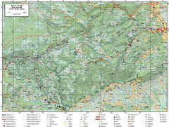
Samobor Region Cycling Route Map
Cycling route map for region west of Samobor, Croatia. Shows all routes in km
92 miles away
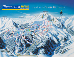
Turracher Höhe Ski Trail Map
Trail map from Turracher Höhe.
94 miles away
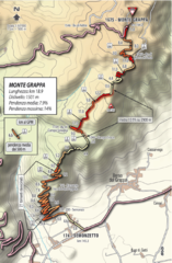
Monte Grappa Giro Stage 14 Cycling Route Map
Cycling route of the climb up Monte Grappa in Stage 14 of the 2010 Giro d'Italia. Averages 8...
95 miles away
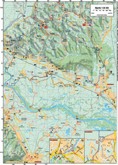
Sulta and Sava Croatia Cycling Route Map
the trails on this map are through picturesque hills to the confluence of the Sutla and Sava Rivers...
100 miles away
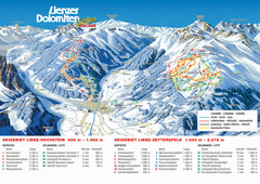
Lienz Austria Ski Map
Trail map for Lienz ski resort in Austria. Lifts, runs, elevations and amenities marked on map.
100 miles away
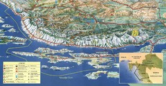
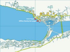
Pag Island Panoramic Map
Shows area around island of Pag, Croatia
102 miles away
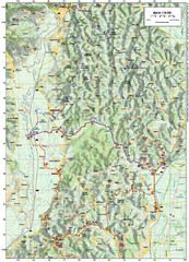
Villages and Sutla River Valley Bike Route Map
Bike routes and trails through the villages to the Sutla River Valley in Croatia. Note: The map...
104 miles away
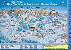
San Martino di Cartozza Ski Trail Map
Ski trail map of San Martino di Cartozza, Italy
105 miles away
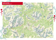
Cortina d'Ampezzo Hiking Map
Summer hiking map of the Cortina d'Ampezzo, Italy area in the heart of the Dolomite Mountains...
105 miles away
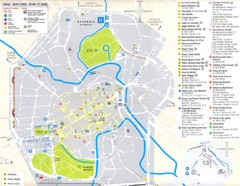
Vicenza Map
106 miles away
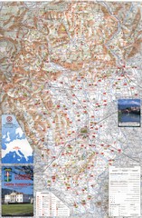
Vicenza Tourist Map
Tourist map of region around Vicenza, Italy. Shows points of interest. In Italian. Scanned.
106 miles away
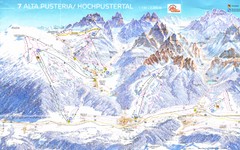
Alta Pusteria Ski Trail Map
107 miles away
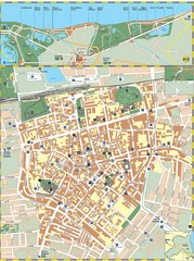
Ravenna Street Map
Street map of central Ravenna, Italy.
107 miles away
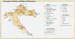
Croatia Economic Activity Map
Map of Croatia's economic activity and natural resources
108 miles away

Ravenna Map
108 miles away
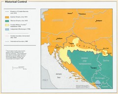
Croatia Historical Control Map
109 miles away
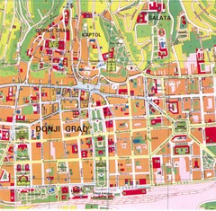
Zagreb Tourist Map
Tourist map of central Zagreb, Croatia. Shows major buildings.
110 miles away
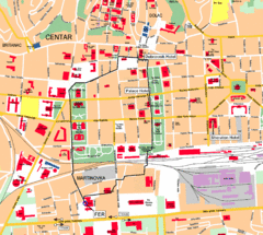
Zagreb Center Map
110 miles away
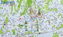
Zagreb Croatia Tourist Map
Zagreb City Centre Tourist map showing tourist attractions, hotels, tourist information and city...
110 miles away
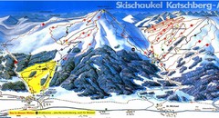
Lungau Ski Trail Map
Trail map from Lungau.
111 miles away

