
Double Decker Tour Bus Map
6 miles away

Municipal Railway Map
6 miles away
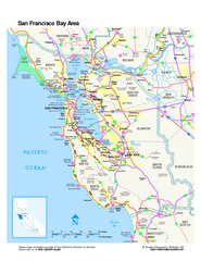
San Francisco Bay Area Map
Overview road map of the San Francisco Bay Area, California
6 miles away
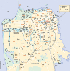
San Francisco Neighborhood Map
Neighborhood map of San Francisco, CA. Shows 49 mile scenic drive.
6 miles away
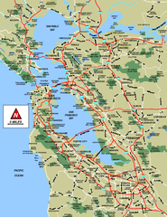
San Francisco Bay Area Map
6 miles away

San Francisco Bay Area Faults and Earthquake...
6 miles away
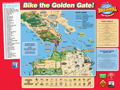
San Francisco Bike Map
6 miles away
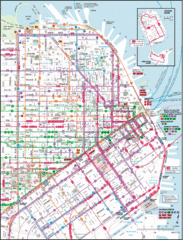
San Francisco Map
Highly detailed map of San Francisco roads and transportation.
6 miles away
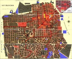
San Francisco Crime Map
A visual representation of crime in San Francisco. This high-level city map of San Francisco shows...
6 miles away
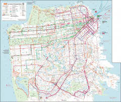
San Francisco Muni system map
Transit Muni system map shows all bus, subway metro, cable car, and streetcar routes.
6 miles away
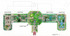
Conservatory of Flowers Museum Map
Map of the Conservatory of Flowers in Golden Gate Park, San Francisco, California
6 miles away
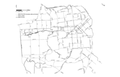
San Francisco Bike Map
Streets in San Francisco
6 miles away
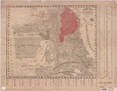
1907 San Francisco Earthquake Map
Map of areas destroyed by fire after 1906 earthquake
6 miles away
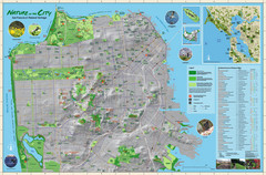
San Francisco Natural Heritage Map
Shows San Francisco's natural habitats and biodiversity is filled with fun facts, restoration...
6 miles away

Bay to Breakers race course Map
Bay to Breakers course. Held annually on the third Sunday in May. "ING Bay to Breakers...
7 miles away
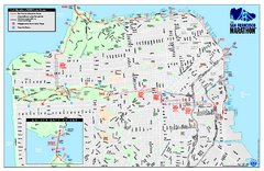
San Francisco 2009 Marathon Map
Guide to the 2009 San Francisco Marathon and Half Marathon
7 miles away
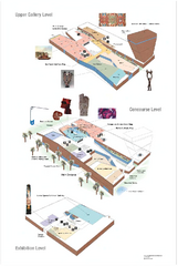
de Young Museum Map
Floorplan of the de Young Museum of Art in Golden Gate Park, San Francisco, California
7 miles away
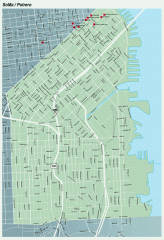
SoMa, Potrero Hill tourist map
Tourist map of SoMa and Potrero Hill in San Francisco
7 miles away
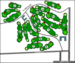
Lincoln Park Golf Course Map
7 miles away
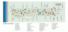
Golden Gate Park tour map
Map of Golden Gate Park in San Francisco in California. Shows all points of interest, picnic areas...
7 miles away
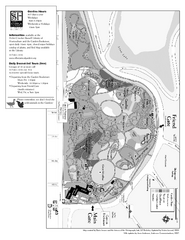
San Francisco Botanical Garden Map
Overview map of the San Francisco Botanical Garden in Golden Gate Park, San Francisco
7 miles away
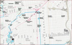
Castro, Mission, Haight-Ashbury, Noe Valley map
Tourist map of Castro, Mission, Haight-Ashbury, Noe Valley, and Twin Peaks in San Francisco
7 miles away
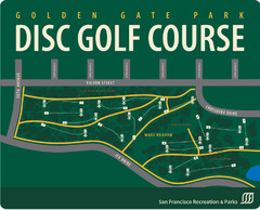
Golden Gate Park Disc Golf Course Map
Disc golf course map of 18-hole course in Golden Gate Park, San Francisco, CA. Officially opened...
7 miles away
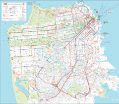
San Francisco Public Transportation map
Transit Muni system map shows all bus, subway metro, cable car, and streetcar routes.
7 miles away
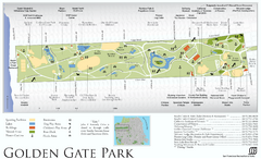
Golden Gate Park Map
Overview map of Golden Gate Park in San Francisco, CA
7 miles away
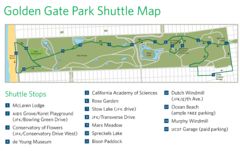
Golden Gate Park Shuttle Map
Shows shuttle stops in Golden Gate Park, SF.
7 miles away
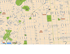
Downtown San Francisco: Castro and Noe Valley Map
Tourist map of the Castro and Noe Valley area in downtown San Francisco, California. Shows Twin...
7 miles away
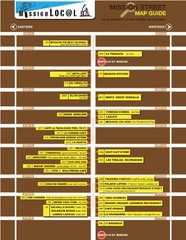
San Francisco Mission Restaurant Map
7 miles away
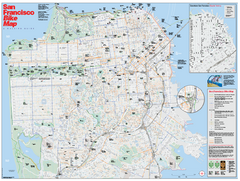
San Francisco Bike Map
Map showing bike paths, bike lanes, bike shops, public transportation, and grades of hills in San...
7 miles away
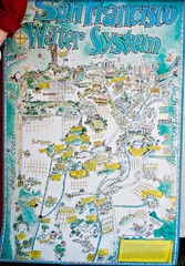
San Francisco Water System Cartoon Map
Cartoon map of the San Francisco Water System. From photo of poster from San Francisco Public...
7 miles away
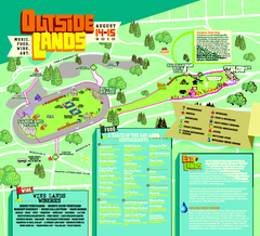
Outside Lands Festival Map 2010
Official Outside Lands Festival map 2010. Held Aug 14-15, 2010 in Golden Gate Park, San Francisco
7 miles away
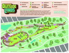
San Francisco Outside Lands Music Festival Map
Official 2008 map of the Outside Lands Music & Arts Festival in Golden Gate Park, San Francisco...
7 miles away
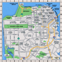
San Francisco Neighborhoods Map
7 miles away
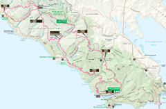
Headlands 50K Map (for 2011 race and future races)
Course For 2011 Headlands 50K
8 miles away
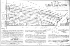
1914 Bouquet Key Route Business Block Map
This map shows the borders of the Bouquet Business District in Contra Costa County, CA
8 miles away
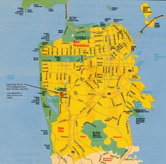
San Francisco City Map
City map of San Francisco with Lowell High School highlighted
8 miles away
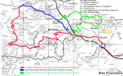
Alpine Dam Seven Sisters Road Bike Route Map...
Road biking route map for the classic Alpine Dam/Seven Sisters loop in Marin County from San...
8 miles away
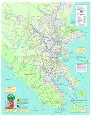
Marin Bicycle Map - Side A
Bike route map of Marin County, California. Shows primary and secondary road routes, paved and...
9 miles away
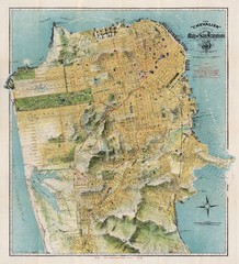
Chevalier map of San Francisco (1912)
Breathtaking map of San Francisco in 1912 by August Chevalier from the BIG Map Blog by way of DRMC.
9 miles away
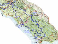
Golden Gate Headlands 50k Course Map
Here is a map of the 31-mile course for the Golden Gate Headlands: USATF National 50K Trail...
9 miles away

