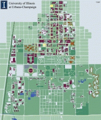
University of Illinois at Urbana-Champaign campus...
Map of the University of Illinois at Urbana-Champaign campus. Shows building names but not street...
170 miles away
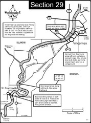
Vincennes, IN/ St. Francisville, IL Wabash River...
This is a page from the Wabash River Guidebook. The map shows important information for boaters and...
170 miles away
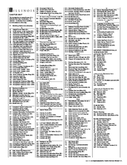
University of Illinois at Urbana-Champaign Map
Campus map of University of Illinois at Urbana-Champaign. All buildings shown.
170 miles away
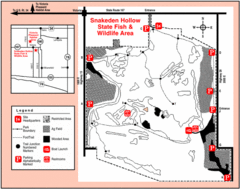
Snakeden Hollow State Park, Illinois Site Map
170 miles away

Vicennes and Knox County Indiana Visitor Map
Street map of Vicennes with maps of the entire state and county as well.
170 miles away
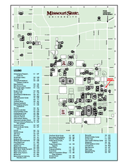
Missouri State University Map
Missouri State University Campus Map. All buildings shown.
171 miles away
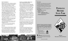
Powhatan Historic State Park Map
Map of the historic buildings of Powhatan State Park.
172 miles away
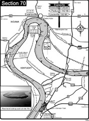
Ohio River at Evansville, IN and Henderson, KY Map
This is a page from the Ohio River Guidebook. The map shows important information for boaters and...
172 miles away
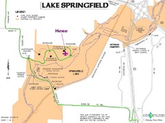
Camp Arrowhead Map
Boy Scouts of America Map at Lake Springfield
173 miles away
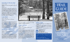
Lake Charles State Park Trail Map
Map of trails for Lake Charles State Park including othe park sites and amenities.
173 miles away
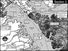
Kentucky Lake Tennesssee River-Land Between the...
This is the upper end of Kentucky Lake which is the Tennessee River. The map is designed for...
173 miles away
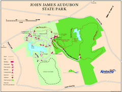
John James Audubon State Park Map
Map of trails, facilities and historical sites in John James Audubon State Park.
175 miles away
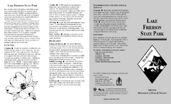
Lake Frierson State Park Map
Map of Lake Frierson State Park showing trails, boating and fishing areas and amenities.
177 miles away
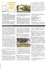
Wilson's Creek National Battlefield Official...
Official NPS map of Wilson's Creek National Battlefield in Missouri. Open Daily, except...
178 miles away
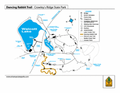
Dancing Rabbit Trail - Crowley's Ridge State...
Trail Map for Dancing Rabbit Trail in Crowley's Ridge State Park showing Walcott Lake, hiking...
181 miles away
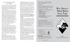
Bull Shoals White River State Park Detail Map
Bull Shoals - White River State Park Area Map including amenities.
182 miles away

Arkansas International Airport Map
182 miles away

Bull Shoals White River State Park Map
Lake Map of Bull Shoals White River State Park
182 miles away

Bull Shoals-White River State Park map
Detailed recreation map for Bull Shoals-White River State Park in Arkansas
182 miles away
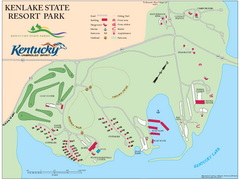
KenLake State Resort Park Map
Map of trails, facilities, and golf course for the KenLake State Resort Park located on the mid...
183 miles away
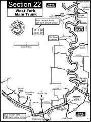
Petersburg, IN White River West Fork Map
This is a page from the White River Guidebook. The map shows important information for boaters and...
184 miles away
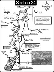
Terre Haute, IN Wabash River Map
This is a page from the Wabash River Guidebook. The map shows important information for boaters and...
187 miles away
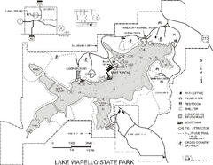
Lake Wapello State Park Map
Map of trails, lake depths and fishing spots at Lake Wapello State Park.
188 miles away
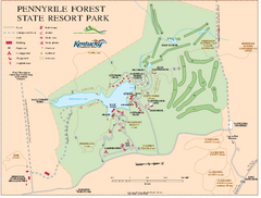
Pennyrile State Resort Park map
Recreation map for Pennyrile Forest State Park in Kentucky
190 miles away
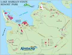
Lake Barkley State Resort Park Map
Map of the trails and facilities of Lake Barkley State Resort Park.
190 miles away
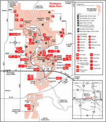
Kickapoo State Park, Illinois Site Map
192 miles away
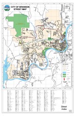
Branson Street Map
Street map of Branson, Missouri. With street index.
193 miles away
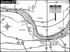
Ohio River at Owensboro, Kentucky Map
This is a page from the Ohio River Guidebook. The map shows important information for boaters and...
195 miles away
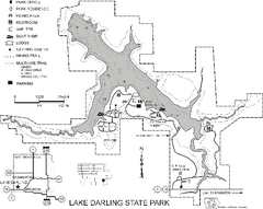
Lake Darling State Park Map
Map of hiking, biking and skiing trails, lake depths and park facilities for Lake Darling State...
195 miles away
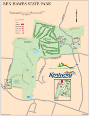
Ben Hawes State Park Map
Map of trails, facilities and golf course in Ben Hawes State Park.
195 miles away
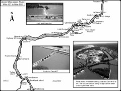
Upper Mississippi River Mile 427 to Mile 502 Map
Historical Map from book "Mississippi River-Historical Sites and Interesting Places
196 miles away
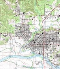
Batesville City Map
Topographic city map of Batesville, Arkansas
199 miles away
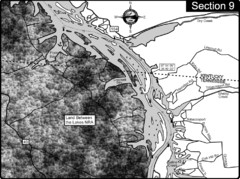
Lake Barkley-Cumberland River Map
Portion of Lake Barkley formed on the Cumberland River. In this section the state line is shown...
199 miles away

Ski Snowstar Ski Trail Map
Trail map from Ski Snowstar, which provides downhill and night skiing. It has 6 lifts servicing 14...
200 miles away
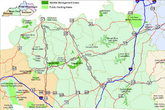
Green River Area Hunting Map
Map marking highways, forests, parks and hunting zones in Kentucky's beautiful Green River...
200 miles away
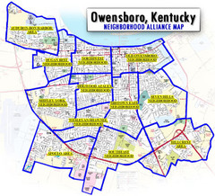
Owensboro, Kentucky City Map
200 miles away
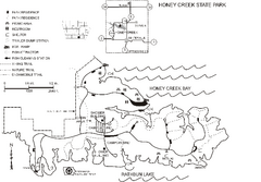
Honey Creek State Park Map
Map of trails, fishing spots and park facilities for Honey Creek State Park.
201 miles away

Rock Island State Park, Illinois Site Map
202 miles away
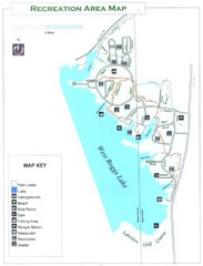
West Boggs Park Map
202 miles away

Wildcat Den State Park Map
Map of trails and facilities at Wildcat Den State Park.
203 miles away

