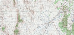
Delta Quad Sheet Detail 1972 Map
318 miles away
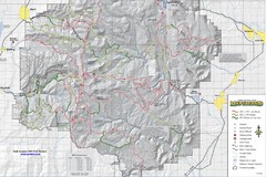
Utha Arapeen OHV Trail System- South Map
Utah Arapeen OHV Trail System map. Located near the towns of Fairview, Ephraim, and Manti, Utah.
318 miles away
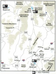
Icefishing Map, Elko County, Nevada
Map of ice fishing locations in Elko County, NV. Shows reservoirs, roads and towns.
318 miles away
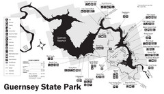
Guernsey State Park Map
The park has long been known as a haven for boating, camping, hiking and picnicking, but its real...
319 miles away
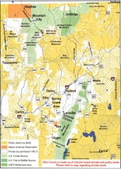
Land Use Map of Elko County, Nevada
Land use map of Elko County, Nevada. Shows lands classified as public or private, and owners of...
320 miles away
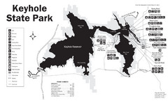
Keyhole State Park Map
Keyhole State Park is located on the western edge of the famed Black Hills, between Sundance and...
321 miles away
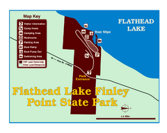
Finley Point State Park Map
This park is located in a secluded, mature pine forest near the south end of Flathead Lake. Enjoy...
321 miles away
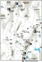
Cross-country Skiing, Elko County, Nevada Map
Map of cross-country skiing opportunities in Elko County, Nevada. Shows skiing locations, roads...
322 miles away
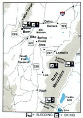
Skiing and Sledding in Elko County, Nevada Map
Map of skiing and sledding opportunities in Elko County, Nevada, showing skiing and sledding...
323 miles away
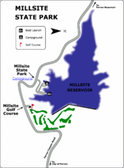
Millsite State Park Map
Camp in the quiet campground, and boat and fish on the blue waters of Millsite Reservoir. Play 18...
323 miles away
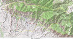
Fruita 18 Road Trail Map
Mountain biking trail map of the 18 Road area in Fruita, CO including Chutes & Ladders, Zipity...
323 miles away
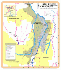
Hells Canyon National Recreation Area Map
Official Forest Service map of the Hells Canyon National Recreation Area. Shows roads, trails...
324 miles away
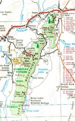
Ruby Mountains Area Map
Included are the communities of Elko, Wells, Deeth, Jiggs, Lee, Lamoille and Spring Creek. Some...
325 miles away
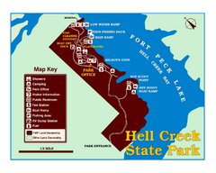
Hell Creek State Park Map
You’ll reach this campground park, 25 miles north of Jordan, through the spectacular scenery...
325 miles away

Snowmobiling Map, Elko County, Nevada
Map of snowmobiling opportunities in Elko County, Nevada. Snowmobiling areas, roads, and towns are...
325 miles away
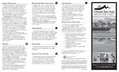
Highline Lake State Park Map
Map of park with detail of recreation areas
325 miles away
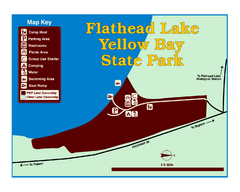
Yellow Bay State Park Map
Yellow Bay is in the heart of the famous Montana sweet cherry orchards, blossoms color the...
326 miles away
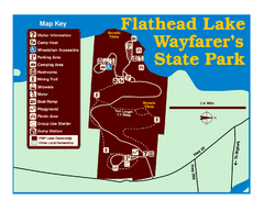
Wayfarers State Park Map
328 miles away
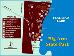
Big Arm State Park Map
Clear map and map key of Park camping grounds.
328 miles away
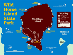
Wild Horse Island State Park Map
Boat access to this day-use-only, primitive park is regulated to protect the 2,000-acre island. The...
328 miles away
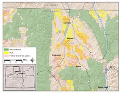
North Park Colorado Map
329 miles away
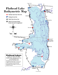
Bathymetric Map of Flathead Lake
Bathymetry refers to underwater depth
330 miles away
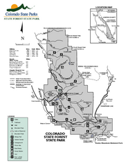
State Forest State Park Map
Map of park with detail of trails and recreation zones
332 miles away
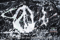
Ferguson Ridge Ski Trail Map
Trail map from Ferguson Ridge.
332 miles away
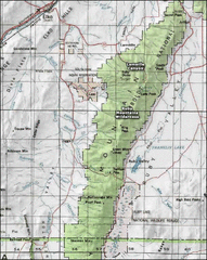
Ruby Mountains Wilderness Map
Overview map of Ruby Mountains Wilderness and Lamoille Canyon
332 miles away
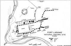
Fort Laramie Guide Map
A layout of the National Historic site Fort Laramie in Wyoming.
333 miles away
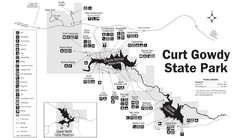
Curt Gowdy State Park Map
Curt Gowdy is a recreation area with three reservoirs. It's great for fishing, camping, water...
333 miles away
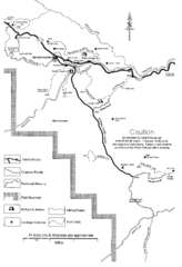
Capitol Reef Trail Map
Hiking trails near Fruita, Colorado
335 miles away
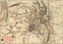
Denver and Rio Grande and Rio Grande Western...
Shows the Denver & Rio Grande and Rio Grande Western railroad system map circa 1904
336 miles away
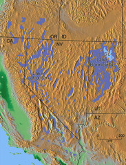
Pleisocene Lakes of western U.S. Map
337 miles away
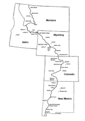
Continental Divide Trail Graphic Map
Guide to the Continental Divide Trail, with major cities and stopping points
337 miles away
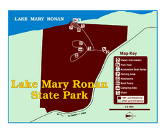
Lake Mary Ronan State Park Map
Off the beaten path just seven miles west of Flathead Lake, this park is shaded by Douglas fir and...
337 miles away
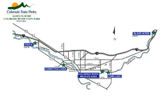
James M Robb Colorado River State Park Map
Overview map of park along lake
340 miles away

Glenwood Springs, CO carved by CarvedMaps.com Map
Glenwood Springs, Colorado carved by CarvedMaps.com Virtually anywhere within the US can be carved...
340 miles away
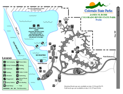
Fruita Area State Park Map
Map of fruita section of the James M Robb Colorado River State Park
342 miles away

Blacktail Mountain Ski Area Ski Trail Map
Trail map from Blacktail Mountain Ski Area.
342 miles away
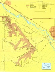
Colorado National Monument Map
Map of Colorado National Monument and surrounding areas.
342 miles away
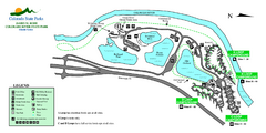
Island Acres State Park Map
Map of island acres section of the James M Robb Colorado River State Park
342 miles away
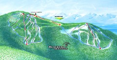
Blacktail Mountain Ski Trail Map
Official ski trail map of Blacktail Mountain ski area. See Blacktail's site for trailnames.
343 miles away
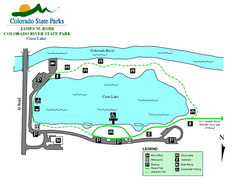
Corn Lake State Park Map
Map of corn lake section of the James M Robb Colorado River State Park
343 miles away

