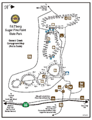
Sugar Pine Point State Park Campground Map
Map of campground region of park with detail of trails and recreation zones
144 miles away
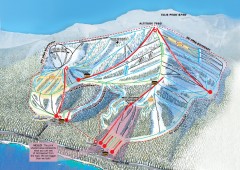
Homewood Ski Trail Map
Official ski trail map of Homewood ski area from the 2007-2008 season.
144 miles away
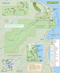
Sugar Pine Point State Park Map
Map of park with detail of trails and recreation zones
145 miles away
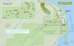
Sugar Pine Point State Park North Map
Map of northern region of park with detail of trails and recreation zones
145 miles away
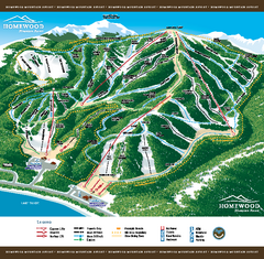
Homewood Mountain Resort Ski Trail Map
Trail map from Homewood Mountain Resort, which provides downhill and terrain park skiing. It has 7...
145 miles away
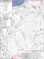
Tahoe Rim Trail: Kingsbury South to Big Meadows...
Topographic hiking map of the Kingsbury South-Big Meadows leg of the Tahoe Rim Trail. Shows...
145 miles away
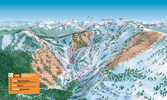
Alpine Meadows Ski Trail Map (Front)
Official ski trail map of Alpine Meadows ski area from the 2005-2006 season.
145 miles away
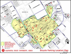
California State University, Chico Bike Parking...
Map that highlights all the available bike parking area and bike routes throughout the campus and...
145 miles away
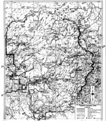
1931 Yosemite National Park Map
Yosemite National Park Map with trails and elevations
146 miles away
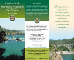
Mendocino Headlands State Parks Map
Map of parks with detail of trails and recreation zones
146 miles away
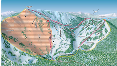
Alpine Meadows Ski Area Backside Ski Trail Map
Trail map from Alpine Meadows Ski Area, which provides downhill and terrain park skiing. It has 13...
146 miles away
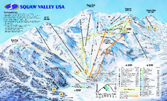
Squaw Valley USA Trail Map
Trail map of Squaw Valley ski area in Lake Tahoe, California
147 miles away
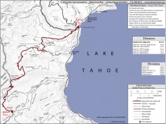
Tahoe Rim Trail: Barker Pass to Tahoe City Map
Topographic hiking map of the Barker Pass-Tahoe City leg of the Tahoe Rim Trail. Shows trailheads...
147 miles away
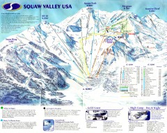
Squaw Valley Ski Trail Map
Scan of ski trail map of Squaw Valley ski area from the 2000-2001 season.
147 miles away
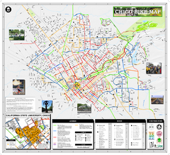
Chico Bike Map
Bicycle route map of Chico, California
147 miles away

Chico, California City Map
147 miles away
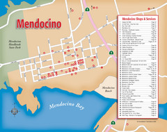
Mendocino Tourist Map
Tourist map of town of Mendocino, California. Shows shops and services.
147 miles away
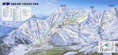
Squaw Valley USA Ski Trail Map
Trail map from Squaw Valley USA, which provides downhill, night, nordic, and terrain park skiing...
148 miles away
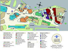
Squaw Valley Base Village Map
Village map of base of Squaw Valley Ski Resort, Lake Tahoe, California. Shows all restaurants...
148 miles away
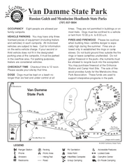
Russian Gulch State Park Campground Map
Map of campground region of park with detail of trails and recreation zones
148 miles away
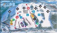
Soda Springs Ski Trail Map
Trail map from Soda Springs, which provides downhill and terrain park skiing. It has 2 lifts...
149 miles away
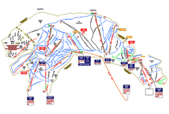
Heavenly Ski Resort Ski Trail Map
Trail map from Heavenly Ski Resort, which provides downhill, nordic, and terrain park skiing. It...
149 miles away
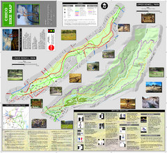
Upper and Lower Bidwell Park Bike Map
Bike map of Upper Bidwell Park and Lower Bidwell Park in Chico, California
149 miles away
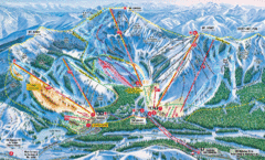
Sugar Bowl Resort Ski Trail Map
Trail map from Sugar Bowl Resort, which provides downhill and terrain park skiing. It has 12 lifts...
149 miles away
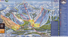
Sugar Bowl Ski Trail Map
Ski trail map of Sugar Bowl ski area from the 2008-09 season. Scanned.
150 miles away
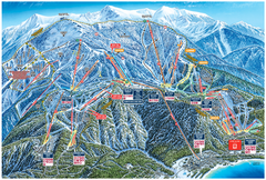
Heavenly Valley Ski Trail Map
Official ski trail map of Heavenly Valley ski area from the 2007-2008 season.
150 miles away
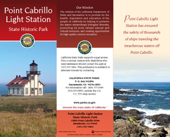
Point Cabrillo Light Station State Historic Park...
Map of park with detail of trails and recreation zones
150 miles away
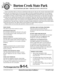
Burton Creek State Park Map
Map of park with detail of trails and recreation zones
150 miles away
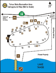
Tahoe State Recreation Area Campground Map
Map of park with detail of trails and recreation zones
150 miles away
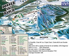
Donner Ski Ranch Ski Trail Map
Trail map from Donner Ski Ranch, which provides downhill and terrain park skiing. It has 6 lifts...
150 miles away
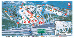
Boreal Ski Trail Map
Official ski trail map of Boreal ski area
151 miles away
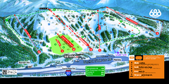
Boreal Mountain Resort Ski Trail Map
Trail map from Boreal Mountain Resort, which provides downhill, night, and terrain park skiing. It...
151 miles away
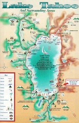
Lake Tahoe and nearby activities Map
Lake Tahoe and nearby resorts and activities
151 miles away
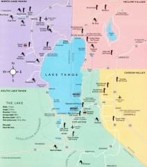
Lake Tahoe Area, California Map
Recreation map of Lake Tahoe, California. Points of interest shown include golfing, skiing, and...
151 miles away
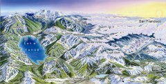
Lake Tahoe Ski Resort map
Winter map of Lake Tahoe showing relative position of all ski resorts. South-facing view. Created...
151 miles away

Digital Elevation Model Satellite Tahoe Map
Digital Elevation Models
151 miles away
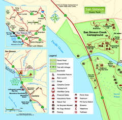
San Simeon State Park West Map
Map of west region of park with detail of trails and recreation zones
152 miles away
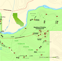
San Simeon State Park East Map
Map of east region of park with detail of trails and recreation zones
152 miles away

San Simeon State Park Map
Map of park with detail of trails and recreation zones
152 miles away
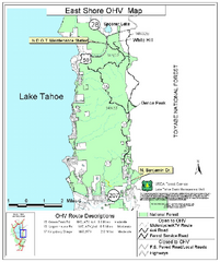
East Shore Lake Tahoe Off-highway Vehicle Map
Off-highway vehicle map of the East Shore of Lake Tahoe, California. Shows roads open to...
153 miles away

