Could not geocode “samnabbad”: no answer to geocode request.
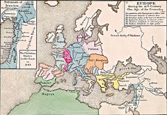
Old Map of Europe - 12th century
Near london
1261 × 869•414 KB•JPG

Negril tourist map (updated April 2008)
Near negril jamaica
411 KB•PDF
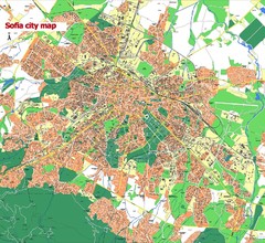
Sofia City street map
Map of Sofia city, Bulgaria. Bulgaria is country in Europe, member of the EU since 2007.
Near sofia, bulgaria
852 × 782•334 KB•JPG
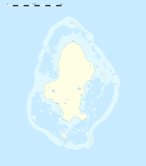
Wallis Location Map
shared under http://creativecommons.org/licenses/by-sa/3.0/deed.en
Near Wallis Island
2000 × 2259•230 KB•PNG
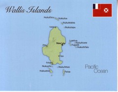
Wallis Islands Postcard Map
Near Wallis Islands
1093 × 849•46 KB•JPG

Wallis Island North Map
Near Wallis Island
4967 × 3508•3.0 MB•JPG
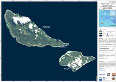
Futuna and Alofi Satellite Map
Near Futuna Island
4967 × 3508•1.8 MB•JPG
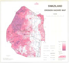
Swazilad soil erosion Map
3778 × 3460•977 KB•JPG
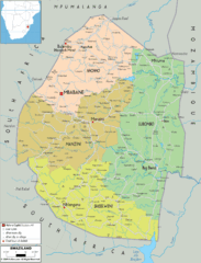
Swaziland political Map
1412 × 1847•502 KB•GIF

Bandar Seri Begawan city Map
1044 × 1378•206 KB•JPG
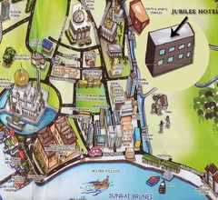
Sungai tourist Map
Near sungai brunei
545 × 500•69 KB•JPG

Brunei Map
1419 × 1060•288 KB•JPG

Kerguelen Island detail Map
Near kerguelen island
717 × 1004•267 KB•JPG

Kerguelen Island land use Map
Near kerguelen island
1000 × 1000•85 KB•PNG

Kerguelen Island soil Map
Near kerguelen island
1046 × 1044•42 KB•GIF

Kerguelen Island topo Map
Near kerguelen island
1840 × 1915•2.1 MB•PNG
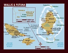
Wallis and Futuna Map
Near Wallis and Futuna
516 × 400•48 KB•JPG

Wallis and Futuna Map
Near Wallis and Futuna
500 × 550•36 KB•JPG
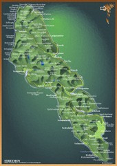
Streymoy Island Map
1088 × 1533•576 KB•JPG
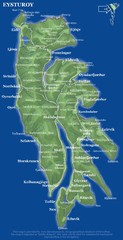
Eysturoy island Map
574 × 1116•101 KB•JPG
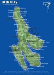
Bordoy island Map
569 × 796•131 KB•JPG
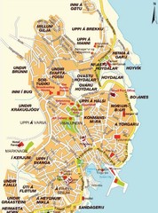
Torshavn city Map
Near faroe islands
452 × 609•87 KB•JPG

Islands of Wallis and Futana Map
Near Wallis and Futana
568 KB•PDF
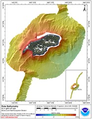
Rota island bahtymetric Map
Near rota island
5100 × 6599•1.3 MB•JPG

Pagan island bathymetric Map
Near pagan island
5904 × 4561•1.2 MB•JPG

Northern Mariana islands Map
Near northern marianas
4250 × 5500•3.1 MB•JPG
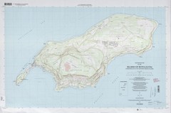
Rota island topo Map
Near rota island
5000 × 3304•2.0 MB•JPG

Tinian island topo Map
Near tinian
3495 × 5000•1.6 MB•JPG

Truk atoll Map
Near 152 e 7 30 n
835 × 975•153 KB•JPG

Jaliut atoll Map
Near 169 30 e 6 00 n
819 × 1064•113 KB•JPG

Maleolap and Aur atoll Map
Near arno atoll
614 × 854•74 KB•JPG

Arno atoll Map
Near arno atoll
500 × 405•24 KB•JPG

Taka atoll Map
Near taka atoll
1276 × 885•62 KB•JPG

Majuro atoll Map
Near marshall islands
800 × 1153•43 KB•JPG

Kwajelein atoll Map
Near Kwajelein atoll
800 × 1154•50 KB•JPG
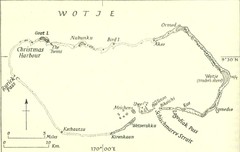
Wotje atoll Map
Near wotje atoll
828 × 525•63 KB•JPG
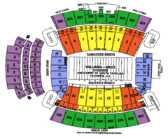
Williams Brice seating map
Near columbia, sc
608 × 498•76 KB•GIF
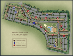
woodlands of Columbia map
Near columbia, sc
650 × 500•406 KB•PNG
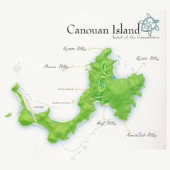
Canouan island Map
450 × 450•25 KB•JPG
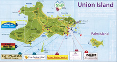
Union island tourist Map
2505 × 1335•3.9 MB•JPG
page 17 of 379

