Edit this map

Groningen City Map

near Groningen, The Netherlands

View LocationView Map

53.2166725562876 6.56673431396484 14 satellite
Nearest Map »  Fullsize
1888 × 1892989 KBJPG

City map of central Groningen, The Netherlands. Some hotels highlighted.

From liber.ub.rug.nl

mapluvr added
Jul 9, 2008

Rating
rated 3 by 1 person

See an error? Report it.

Keywords

reference, city, netherlands

0 Comments

New comments have been temporarily disabled.
.
See more

Nearby Maps

Borkum Street Map

Borkum Street Map

Street map of town of Borkum

26 miles away

Near Borkum, Germany
Norderney Tourist Map

Norderney Tourist Map

Tourist street map of Norderney

41 miles away

Near Norderney, Germany
Aurich Tourist Map

Aurich Tourist Map

Aurich tourist street map

42 miles away

Near Aurich, Germany
Keywords: tourism, city, downtown
Europe Political Map

Europe Political Map

54 miles away

Near Europe
Keywords: reference
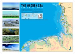
Wadden Sea Map

Wadden Sea Map

Map of Wadden Sea area and trilateral conservation area. Consists of lands and waters in The...

54 miles away

rated 4 by 1 person
Near Wadden Sea
Nordhorn Center Map

Nordhorn Center Map

Street map of Nordhorn town center

59 miles away

Near Nordhorn, Germany
See more