Cochise County Map
near Cochise County, Arizona
See more


 See more
Nearby Maps

Kartchner Caverns State Park Map
Map of park with detail of trails and recreation zones
24 miles away
Near Kartchner Caverns State Park, Benson, AZ

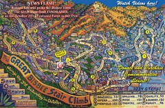
Bisbee, AZ Stairclimb 2010 Map
5K race map. This map does not do the website justice. Definitely a must-see.
26 miles away
Near Bisbee, AZ

Sierra Vista Transit Route Map
Route Map of Sierra Vista Transit Bus System. Includes all transit routes, bus stops, streets...
27 miles away
Near Sierra Vista, Arizona, USA

Light Rail Route Map
Map of Light Rail system throughout Sierra Vista
27 miles away
Near Sierra Vista, Arizona

Geological Map of the San Pedro River
This is a map of the San Pedro River valley up to where it joins the Gila.
28 miles away
Near sierra vista, AZ

 click for
 Fullsize


0 Comments
New comments have been temporarily disabled.