Canada Imports Cartogram 2003 Map
View Location
Cartograms are a great way to visualize statistics! Here the world's countries are re-sized according to the value of their exports to Canada in 2003.
See more


 See more
Nearby Maps

Canada's Import by Country (2003) Map
Cartograms are a great way to present statistical information. The size of each country is re-sized...
60 miles away
Near caNADA

Canada Province Map
63 miles away
Near Canada

Canada Guide Map
199 miles away
Near Canada

Canada Land Cover Map
Shows color-coded land cover regions of Canada. In French and English.
270 miles away
Near Canada

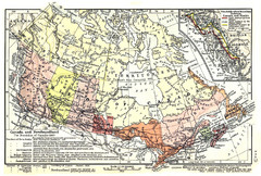
1911 Map of Canada and Newfoundland by Shepherd
This map was from the beautiful 1911 Historical Atlas by William R. Shepherd. Enjoy it!
305 miles away
Near Canada

 click for
 Fullsize


0 Comments
New comments have been temporarily disabled.